Day_199 : Early Signs of Geological Changes Before Landslides

Before significant landslides occur, various clear natural changes are often observed. Notable incidents include the 1963 Vajont Dam landslide in Italy and the 2006 Leyte Island landslide in the Philippines.

On the evening of October 9, 1963, a massive landslide took place near the Vajont Dam in the Alps of northern Italy. The dam, standing at 262 meters, was completed just three years prior. The landslide dislodged approximately 260 million cubic meters of earth, thrusting up the waters of the dam’s lake. The displaced water surged over the dam, rising more than 100 meters before rushing down into the valley below, resulting in approximately 2,000 fatalities. The geological layers in the area were unstable, compounded by the increased water levels from the dam. A minor landslide had previously occurred in 1960, and the landslide’s progress accelerated to several tens of centimeters per day just before the disaster. Despite ongoing monitoring, the catastrophic damage could not be prevented.

Day_140 : Natural Disasters in Europe (2) Vajont Dam Collapse


On February 17, 2006, a mountain 800 meters tall on the Philippine island of Leyte succumbed to a vast landslide, displacing around 20 million cubic meters of soil and claiming 1,144 lives. Before the collapse, cracks had appeared on the mountain’s ridge, and rainfall had begun to seep into the ground.

Identifying these early signs of geological change is crucial. By monitoring their progression and predicting potential danger zones, we can enhance our preparedness and safeguard our lives against such devastating natural disasters.

Contents (in Japanese)
Source: URL:https://dil.bosai.go.jp/workshop/2006workshop/gakusyukai21.html


What causes a landslide?


Day_87 : North and Central Americas – Mt. St.Helens and Mt.Pelee

1.Volcanic Disasters

North America
Mount St.Helens erupted in 1980. 57 people were dead.
St.Helens volcanic eruption was really huge. You can see this from the following video.


From environmental and sociological perspectives, the difference between the U.S. and Japan is the people’s and nature’s relationships. This case indicated that somehow. The people are living far from nature, on Mt.Helens. That is why the fatality number was not so large compared to the huge eruption. In Japan, people tend to live near and with nature. This is called “Satoyama” in Japanese. Other Asian countries are the same with Japan.
This will be discussed later.

Caribbean
Mount Pelee
St.Pierre City was destroyed completely in 1902 by Mt. Plee’s eruption.
The population of the city was approx. 28000; almost all were dead, only 2 survived. One of the only two survivors was in prison. The story can be seen from the following video.

2. Climate, meteorological, and hydrological disasters: Hurricanes

North America
In 1900, Galveston’s death toll was over 6,000
2005 Katrina, the death toll was over 1400, and the cost was $100 billion . UDS
In 1998, Mitch reported that 13,700 people were victimized in Honduras and 3,300 in Nicaragua
Caribbean
Hurricane Jeanne,  2800 were killed in Haiti

Disaster data, such as death toll, is sourced from the NIED DIL homepage.

Day_198 : Characteristics of Earthquake Disasters

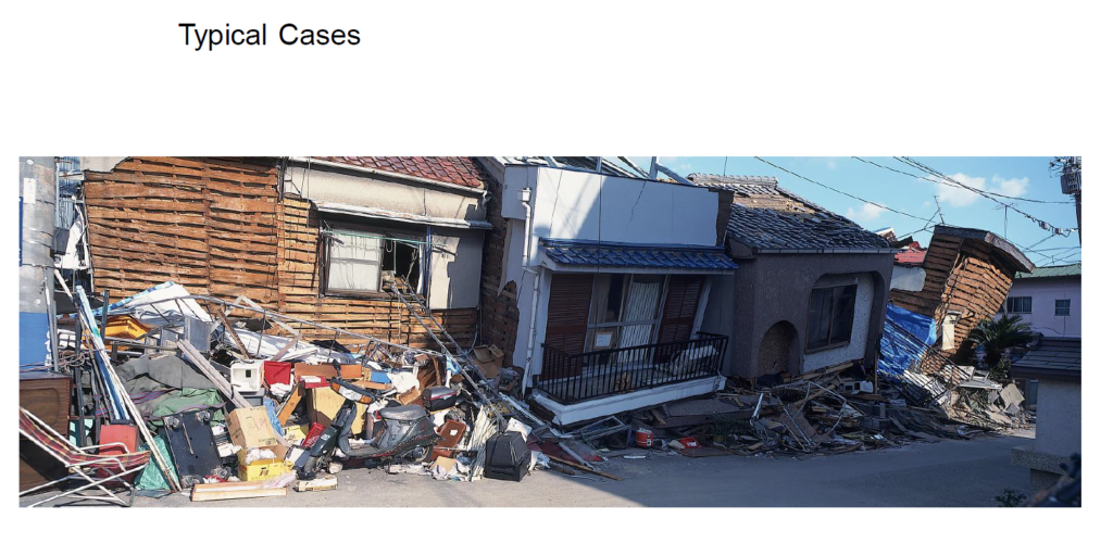
In most cases, when a strong earthquake occurs, many people die as buildings collapse. For example, in the Kobe earthquake, more than 90% of the 5,000 people who died lost their lives within 15 minutes immediately after the quake. For this reason, it is very important to build buildings well in order to reduce the number of people who die in earthquakes. This will prevent fires, make it less likely that people will lose their homes and become permanent refugees, and reduce the problems of relief and rebuilding.

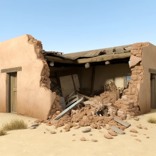
In developing countries, especially in arid and semi-arid regions, earthquakes cause many deaths. In such areas, sun-dried bricks called “adobe” are a common building material, and buildings made of these bricks often collapse easily in earthquakes, burying many people alive. In developing countries, for economic reasons, standards for making buildings earthquake-resistant are often low, and construction is often inadequate. Therefore, even earthquakes that are not that strong can easily cause serious damage. In addition, in regions with many wooden houses, such as Central America and Southeast Asia, not only can buildings collapse, but they can also catch fire.

Day_197 : The Science of Lightning: A Fascinating Force of Nature

Ever caught yourself staring at the sky, mesmerized by lightning during a storm? This natural marvel is not only captivating but also perilous. Despite centuries of study, the intricacies of lightning strikes continue to be a field of active research. In this exploration, we delve into how lightning forms, its types, associated dangers, and the science of thunder, providing insights for both enthusiasts and the casually curious.

Formation of Lightning

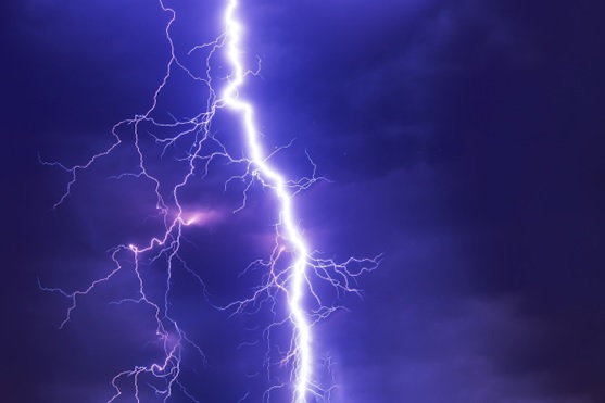
Lightning originates from electric charges accumulating in the atmosphere. This process begins as the sun warms the Earth, causing air to rise, cool, and form clouds. Inside these clouds, the movement of water droplets and ice particles generates an electrical charge. A significant charge difference between parts of the cloud or between the cloud and the ground can ignite a spark—lightning. The intense heat from a lightning strike causes air to expand, creating thunder.

Types of Lightning

Lightning manifests in various forms, including:

Cloud-to-Ground Lightning: The most familiar type, where a bolt strikes from the cloud to the Earth.

Intra-Cloud and Cloud-to-Cloud Lightning: Occurring within or between clouds, respectively.

Ball Lightning: A rare phenomenon of a glowing orb appearing during storms, whose origin remains a mystery.

The Thunder Phenomenon

Thunder is the sound produced by the rapid expansion of air around a lightning bolt. Timing the gap between seeing lightning and hearing thunder can estimate the distance of the strike—every five seconds equals approximately one mile.

Dispelling Lightning Myths

Contrary to popular belief, lightning can strike the same place more than once, especially if it’s a tall structure. Also, while buildings offer better protection than being outdoors, they are not entirely safe from lightning strikes.

Staying Safe During Storms

To minimize risk during thunderstorms:

Stay indoors and unplug electronics.

Seek shelter in a vehicle or sturdy building if outside.

Keep away from tall objects like trees and poles.

Spread out if in a group to reduce the risk of multiple injuries.

Tracking and Protecting Against Lightning

Modern technology, including lightning detectors and mappers, helps track and analyze lightning activity. For protection, lightning rods and surge protectors can safeguard buildings and electronics from strike-induced damages.

Lightning and Climate Change

There’s growing evidence that climate change may increase lightning frequency by creating more thunderstorm conditions. However, further research is needed to understand this relationship fully.

In Conclusion

Lightning, a compelling display of nature’s might, offers much to learn and appreciate. Understanding its science not only enhances our wonder but can also guide us in safeguarding against its dangers. So next time a storm lights up the sky, remember the fascinating science behind each bolt.

Day_138 : Natural Disasters in Europe (1)

Natural disasters in Europe mainly consist of hydrological, meteorological, climatological, earthquake and volcano eruption disasters.

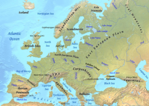
europe-pic
Figure   The Europe

Earthquake disasters mainly occur in the Aegean Sea, the south-western coast of Balkan Peninsula, and the southern part of Italy. Volcanoes are active in the central and southern parts of Italy, the southern Aegean Sea, and Iceland area.

Concerning hydrological, meteorological, and climatological disasters, heavy rain and storm disasters are caused by low  pressure in the Icelandic area developed in the winter season. A cold atmospheric current coming from Arctic gains a warmer vapor stream from the Gulf Stream and develops a strong atmospheric depression in the area. This causes the strong winds and high tidal waves along the coastal areas of the North Sea.

Netherlands and England can be highlighted. The Netherlands had storm surges in 1530 and 1570. The death tolls were approximately 400,000 (1530) and 70,000 (1570) for each. The 1953 depression took an 1800-person death toll. This disaster also reached England. England’s disasters were the 1703 Thames river flood and the 2003 Heatwave. The temperature was 8–10 over the average year in August 2003.

With regard to earthquake disasters, Italy, Greece, and Portugal are the main countries to be affected.

The following past article explains the recent earthquake cases in Italy.

To be continued…

Day_76 : 1995 Kobe Earthquake victims

The 1995 Kobe earthquake taught us a lot of lessons. Today I am going to give you the following two questions:.
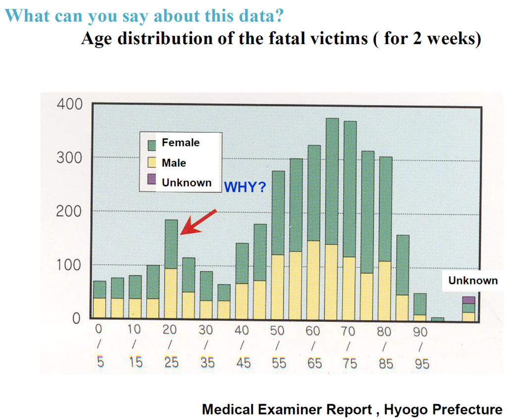
1) Why were there so many early 20s victims?
2) Which floor is more dangerous, 1st or 2nd?

1) Please look at the following picture. You can see the victims’ age distribution. Females and elderlies are more likely to be victimized because of their lack of physical strength. However, why did so many people in their early 20s die? Yes, they were university students. There are many universities in Kobe. Students tended to be less rich. They tended to stay on the 1st floor in cheaper wooden apartments.

kobe victims age distributions

2) You already know the answer. Of course, the first floor is more dangerous, especially in a wooden house. 1981 is the year in which the Japanese government set the building code. So the buildings, apartments, etc. built after the year tended not to be destroyed by the earthquake, including the Kobe earthquake.

1stfloorKobe

Photo: Dr.Takashi Inokuchi

We should learn the lessons from the disaster; this is the best thing we can do for the victims.


Day_30 (rev): The two main gaps


There are two main gaps among experts, local disaster managers, and local people. The first is a perspective gap; experts usually have a different point of view on disaster risk reductions based on their specialty. Disaster managers have a management point of view. The local people tend to have a view based on their daily lives. The other gap is the knowledge gap. Each has a different level of knowledge.

These two gaps keep them from conducting the work for effective disaster risk reduction in a local community.

Once I learned the definition of “expert,” as follows:. This definition definitely gives me some insights.

The expert is the persons who knows more and more about less and less


Day_196 : The Matsushiro Earthquake Center

The following is a reprint of a column I once wrote:

The Matsushiro Earthquake Center, nestled in the historic town of Matsushiro within Nagano Prefecture, represents a pivotal chapter in Japan’s approach to seismic research and disaster mitigation. Established in February 1967 under the auspices of the Japan Meteorological Agency’s Seismological Observatory, this institution was born out of a critical period marked by intense seismic activity. Between August 3, 1965, and April 17, 1966, the region experienced a staggering 6,780 seismic events, ranging from imperceptible tremors to significant quakes measuring intensity 5 and 4 on the Japanese scale. This unprecedented series of earthquakes not only posed a major societal challenge but also catalyzed the center’s founding.

The initiative to establish the center was strongly influenced by the then-mayor of Matsushiro, Nakamura, who famously prioritized the pursuit of knowledge and research over material wealth. This sentiment laid the groundwork for what would become a crucial site for earthquake prediction and disaster preparedness efforts, situated on the historical grounds of the Imperial Headquarters.

Drawing from my experience at the Natural Disaster Information Office and in collaboration with the Precise Earthquake Observation Office of the Japan Meteorological Agency (now known as the Matsushiro Earthquake Observatory), I have had the unique opportunity to organize and delve into discussions from that era. Despite being born after the seismic events in Matsushiro, I find the archival records fascinating. They not only recount the collective efforts of Matsushiro’s residents to forge a disaster-resilient community in the aftermath of the earthquake but also highlight the comprehensive nature of the research conducted.

The inquiries extended beyond seismic analysis, encompassing a holistic examination of the earthquake’s impact on the community. Noteworthy is the health survey conducted on students from a local school, in collaboration with the Matsushiro Health Center and hospital, to assess the psychological and physical effects of the seismic swarms. Moreover, the scope of investigation included studies on earthquake-induced landslides and the repercussions on water infrastructure, showcasing the multifaceted response from various experts and frontline workers of the time.

This rich tapestry of collective memory and scientific inquiry underscores the enduring spirit of Matsushiro—a community united in its commitment to disaster resilience, informed by the lessons of its past.

Ref.

http://researchmap.jp/read0139271/%E7%A0%94%E7%A9%B6%E3%83%96%E3%83%AD%E3%82%B0/

Day_112 : The 1923 Great Kanto Earthquake and Disaster Prevention Day(Tentative)

September 1 is Disaster Prevention Day in Japan. This is because of the 1923 Great Kanto Earthquake. This quake caused over 105,000 casualties and had huge impacts on Japanese society. The Great Kanto Earthquake is the worst disaster in Japanese history. Here, some points are picked up. First, the quake directly attacks the capital city, Tokyo. Second, the disaster killed so many people mainly by fire, not objects falling. Third, rumors made the disaster worse. Fourth, Tokyo has recovered first and strongly.
With regard to the devastated areas, Tokyo and Kanagawa (Yokohama) populated areas were severely affected by the quake. The epicenter was located near Oshima Island in Sagami Bay, south of Tokyo. In Yokohama, 90 percent of all homes were damaged or destroyed. 60 percent of the city’s population became homeless (Brown University).
Concerning the fire, the time at which the earthquake hit was 11:58, so the families had prepared for their lunches. Many families’ cooking stoves were overturned by the quake, causing fires. The fire spread out with strong winds.
In respect of the rumors, the rumors, especially about Koreans, such as “Koreans do criminal activities and cause social confusion,” make the disaster more political. The Home Ministry declared martial law and ordered all sectional police chiefs to make maintenance of order and security top priorities. After the disaster, the radio became popular all over Japan. This is because of the disaster’s lessons.
Concerning the recovery, Shinpei Goto, Mayor of Tokyo, created and proceeded with a reconstruction plan for Tokyo to rebuild better. The basic infrastructure of today’s Tokyo was built during that time. 

*Death numbers were revised after the recent research from over 140,000 to 105,000 because there were several double countings.