Image Source: FreeImages
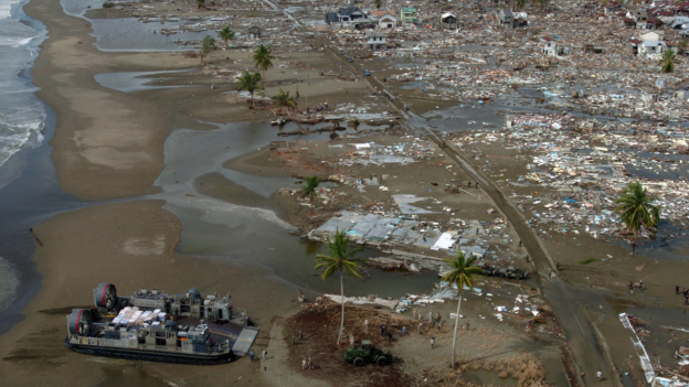
The recent severe earthquake in Turkey has caused significant suffering throughout the country. This catastrophe serves as a stark reminder that natural disasters are far from ordinary occurrences. It is essential for us to learn and grow from each experience, not only within the affected country but also on a global scale. The article discusses Turkey’s earthquake history and how the nation has implemented lessons learned from past events. This analysis highlights the importance of continuous learning in order to better prepare for and respond to such disasters.
Introduction to Turkey’s seismic history
Turkey, a country bordering Europe and Asia, has suffered earthquakes before. It is incredibly vulnerable to these disasters because of its location on the seismically active Anatolian Plate. Turkey has historically seen some of the most damaging earthquakes in the world. Understanding the nation’s seismic history and drawing from its experiences can teach other countries valuable lessons on preparing for and responding to earthquakes.
A better understanding of how to predict, prepare for, and respond to these catastrophes has been made possible by the terrible impacts of earthquakes on Turkey. The country’s response plans have improved, using new engineering innovations and construction techniques to reduce casualties and property damage. In this post, we will examine Turkey’s seismic past, the significance of Adobe architecture there, and the lessons we can draw from Turkey to improve our readiness for and response to earthquakes.
Understanding earthquakes: Causes and types
Energy is released during the shifting and grinding of tectonic plates, which results in earthquakes. Large plates that make up the Earth’s crust are constantly moving and can collide, divide, or slide past one another, which can cause the ground to shake. Tectonic, volcanic, and induced earthquakes are the three main categories of earthquakes. The movement of the Earth’s plates causes the most frequent earthquakes, known as tectonic earthquakes. While induced earthquakes are brought on by human activity, like the mining of natural resources or the construction of huge reservoirs, volcanic earthquakes are brought on by the flow of magma beneath the Earth’s surface.
The Anatolian Plate, which is being compressed between the Eurasian and Arabian Plates, is Turkey’s leading cause of seismic activity. This tectonic activity has created numerous fault lines nationwide, making it vulnerable to earthquakes. For instance, the North Anatolian Fault, a strike-slip fault with a length of more than 1,000 kilometers, has caused multiple disastrous earthquakes in Turkey’s history.
The Significance of Adobe Structures in Turkey
Turkish architecture has long used adobe constructions built of soil mixed with straw or other organic materials. These constructions, frequently seen in rural locations, have served as fortifications, houses, and public facilities. The key benefits of Adobe structures are their affordability, simplicity, and great thermal qualities, which assist in maintaining a comfortable interior temperature all year round.
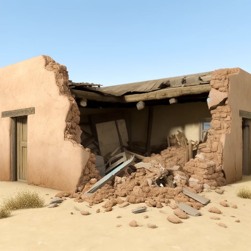
However, regarding seismic activity, Adobe constructions also suffer from serious drawbacks. These structures are particularly prone to collapsing during earthquakes because of their weight and low tensile strength. Throughout Turkey’s history, many large earthquakes have painfully illustrated this susceptibility, resulting in the death of countless people and extensive destruction.
Due to this, Turkey’s rising focus is on enhancing the seismic performance of Adobe structures. Researchers and engineers have been working on developing innovative techniques and materials to increase the earthquake resistance of these traditional structures and preserve their cultural relevance while ensuring the safety of their occupants’ safety.
Major earthquakes in Turkey’s history and their impact
Throughout its history, Turkey has been the site of many large earthquakes, some of which have had devastating effects. The Erzincan earthquake in 1939, the Izmit earthquake in 1999, and the Van earthquake in 2011 are three of the most famous. These seismic occurrences resulted in extensive property damage and fatalities and changed the nation’s strategy for earthquake preparedness and response.
Approximately 33,000 people perished in the 7.9-magnitude earthquake that struck Erzincan in 1939, and many more were injured or left homeless. This catastrophe made it clear that better seismic monitoring, prediction, and earthquake-resistant building techniques are required.
With nearly 17,000 fatalities and more than 50,000 injuries, the 1999 Izmit earthquake, which registered a 7.6 on the Richter scale, was among the deadliest and most catastrophic in modern Turkish history. The significant destruction brought on by this incident highlights the significance of strengthening earthquake preparedness and response strategies.
The most recent earthquake, the 7.1 magnitude Van earthquake in 2011, significantly damaged the Adobe structures in the area, killing over 600 people and displacing thousands more. This catastrophe also emphasized the necessity for improvements in construction methods and supplies for Adobe to improve its seismic performance.
Earthquake preparedness: What we can learn from Turkey
Turkey’s earthquake experiences have taught the country important lessons about preparedness. Adopting strict building regulations that account for seismic risks is crucial to earthquake preparedness. Turkey has made tremendous progress in this area; as of present, the country’s building codes demand that buildings be built resistant to earthquakes.
The creation and upkeep of early warning systems is vital to earthquake preparedness. Turkey has made significant investments in seismic monitoring and early warning systems, which can give locals crucial information in the minutes before an earthquake. By giving people enough time to take refuge or flee dangerous structures, this early warning can help save lives and reduce damage.
Finally, vital elements of earthquake preparedness are public awareness and education. Turkey has put a lot of effort into informing its inhabitants about the dangers of earthquakes and the essential safety measures to follow in the case of one. These are examples of regular earthquake exercises in schools, public awareness campaigns, and the distribution of earthquake safety informational materials.
Building earthquake-resistant Adobe structures
Several important regions have been the focus of efforts to increase the seismic performance of Adobe structures in Turkey. To strengthen their tensile strength and earthquake resistance, old Adobe buildings have been reinforced with contemporary materials like steel or concrete. Concrete columns, reinforced Adobe bricks, or the installation of steel reinforcement bars can all be used to achieve this.
Another strategy is the creation of fresh construction methods that more evenly disperse seismic pressures across the building. Using adaptable hardwood frameworks, using seismic-resistant design concepts, or using cutting-edge materials like fiber-reinforced Adobe are a few examples of how to do this.
Turkish scientists and engineers are also looking into the possibility of enhancing the earthquake resistance of Adobe constructions by employing locally derived ecological materials. This includes using natural fibers to increase the tensile strength of Adobe bricks, such as hemp or straw.
Effective earthquake response strategies in Turkey
The tactics used in Turkey to respond to earthquakes have also been informed. The quick deployment of rescue teams to find and aid stranded or injured people is crucial to an effective earthquake response. Specialized search and rescue squads in Turkey have received funding for training and equipment, and they are frequently among the first to arrive in earthquake-affected areas.
The provision of temporary housing and other services to displaced populations is a vital component of the earthquake response. Turkey has established an effective system for disaster response, including pre-stocked emergency supplies and temporary housing that can be quickly distributed to impacted communities after an earthquake.
Finally, effective earthquake response requires coordinated efforts from national and local governments, non-governmental organizations, and international partners. In the wake of significant earthquakes, Turkey has shown the usefulness of such cooperation, with international aid frequently playing an essential part in the nation’s rebuilding efforts.
Public awareness and education on earthquake preparedness
As informed populations are more prepared to respond to devastating disasters, public awareness, and education are essential to earthquake preparedness. The dissemination of educational materials, public awareness campaigns, and integration of earthquake safety education into school curricula are just a few of Turkey’s steps to increase general understanding regarding earthquake preparedness and response.
The “Safe School Program” is one significant part of Turkey’s public awareness campaigns. Schools are assessed for their capacity to withstand earthquakes as part of this program, and any necessary adjustments are made to protect the safety of students and staff in the event of an earthquake. Regular earthquake exercises are another curriculum feature that aids in preparing children and teachers for seismic occurrences.
International Collaboration for earthquake preparedness and Response
Because earthquakes are worldwide in scope, successful earthquake preparedness and response depend on international cooperation. The establishment of uniform building norms, the exchange of seismic monitoring data, and the provision of aid for disaster response are just a few of the ways that Turkey has actively participated in worldwide initiatives to increase earthquake resilience.
The World Housing Encyclopedia, which attempts to offer details on the seismic performance of structures worldwide, is a key endeavor in this area. Turkey has contributed to this effort by offering important information on the seismic performance of its conventional Adobe structures.
Building a resilient future for Turkey and Beyond
Turkey’s earthquake experiences taught us essential lessons about preparedness and response. Turkey has made tremendous progress in lessening the effects of earthquakes on its population by enacting strict construction rules, creating early warning systems, and improving public awareness about earthquake safety.
Researchers and engineers are looking for new methods and materials to increase the seismic performance of conventional Adobe structures in Turkey, which is a continuous effort. These initiatives could significantly impact earthquake-prone areas worldwide where traditional building materials and techniques are still widely used.
Finally, increasing earthquake resilience globally requires global cooperation and knowledge sharing. By cooperating, nations can benefit from one another’s experiences and create plans to lessen the effects of earthquakes on their populations.
To sum up, Turkey’s seismic past warns about the significance of earthquake preparedness and reaction. We can create a more resilient future for ourselves and future generations by implementing the lessons discovered from Turkey’s experiences in our communities.

