Warning」カテゴリーアーカイブ

Day_206 : That Day in the Storm: A Family’s Harrowing Experience with the Isewan Typhoon (the worst typhoon disaster in Japan, 1959) (Anonymous)

On that day… “A big typhoon is coming,” my father declared, returning home early from work. “If it takes the worst possible path, we’ll be on the right side of the typhoon, so it’s going to be bad,” he said as he nailed wood to reinforce the window glass, preparing for the typhoon as we always did.

By just after 8 PM (?), we had finished dinner and were getting ready for the typhoon. “The wind is getting incredibly strong. The house might collapse,” he worried more than usual about the house falling apart and started to prepare. He stacked futons about a meter high in a U-shape in front of the dresser to create a bunker-like structure, and all five of us got inside.

My brother and I had packed our clothes in plastic bags and were wearing our backpacks. My father, preparing for the house to collapse, had a hammer hanging from his waist. My mother had a flashlight at her waist. The wind grew stronger, and when my father went around the house to check, he called me to help hold the windows.
“For the first time, I understood the ‘breath’ of a typhoon. As the typhoon ‘exhaled’—’Whooosh’—the window glass bulged outward, looking like it might shatter at any moment. Rather than holding it down, it felt more like we were pulling on the window muntins to prevent them from flying away, which was extremely difficult due to the ferocious wind.

“It’s no use. The house is going to collapse. Get under the futons,” he said, and I quickly returned to where my grandmother and brother were. Right after that, “What’s that noise?”… “It’s water!” my father exclaimed. At the front door, water began trickling in through the threshold, dribbling onto the earthen floor.
“We can’t stay in the house with the water. Let’s escape to Akiba Shrine at the back,” he decided.

As he lifted my bent-backed grandmother onto the top tier of the closet, my mother carried my first-grade brother on her back, and my father led me by the hand to the front door. When he opened the sliding door, the murky water reached up to his chest in an instant. “Oh!” was all he could say as he grabbed the post of the sliding door to support himself. The current swept me to the right; only my fingertips managed to cling to either his collar or shoulder blade. At that moment, I saw my mother and brother on the tatami at the front of the house, but I don’t remember anything from then until we got on the roof of the kitchen.

During this time, my mother and brother heard my repeated cries of “My hands are slipping! Help!” And at that same moment, the wooden fence outside the house washed past between my father and the post he was holding, and the muddy water rushed into the house. My father thought he had lost me when my hands slipped from his neck.

My father and I were likely pushed inside by the current. I’m not sure… From then on, my mother and brother only remember fragments. Unable to escape outside, we took refuge in the attic. As the water rose, the tatami mats began to float, and I saw the TV sinking into the water as we fled. The fear of that moment is unforgettable, my mother says. “Even though it was dark due to the power outage, something was still bright,” my father and I said as we clung to the pillars and crossbeams in the courtyard, trying not to float on the rising tatami. The kitchen wall was there, so the water reached the eaves of the roof, which were quite deep, but the force seemed a bit diminished. My father managed to get onto the roof first, holding onto the gutter and then pulling me up onto the roof.

When we crossed the roof, my foot slipped. It was a tin roof. “Don’t slip! Don’t fall! The sea is to the right,” my father’s loud voice I remember well. The stormy weather was intense; looking to the right, the water was a vast expanse, moving incredibly fast and shining brilliantly. I can’t forget the depth of the water and its swift flow.

My mother, carrying my brother, was also swept by the water while clinging to a post between the veranda and the courtyard. My brother recalled, “At that time, I was really uncomfortable squeezed between Kamo-san and our mother’s shoulders.” After seeing me on the roof, my mother managed to get there, clinging to something until my father pulled her up. My father told her to get on the roof too, but she said, “It’s okay. I’m fine here. I can’t go on.” I thought I heard my mother say she was going to die from that moment

on, and I kept screaming, “Help! Help!” but I don’t remember anything after that. Later, my father also pulled her onto the roof.

My father was breaking the tiles on the main roof with a hammer to create an opening to the attic. I don’t remember how I got there, but I found myself near my father on the tin roof, and he was tossing the broken tiles aside and digging into the dirt beneath them. Suddenly, the wind and rain stopped. Looking up, the sky was full of stars. I clearly remember that. Later, I learned that we had been in the eye of the typhoon. Eventually, our family of four entered the attic through this opening in the roof about the size of four tiles. When we got into the attic, I noticed my fingertips were muddy and slightly bleeding.

My father warned my brother, “Be careful with the thin ceiling boards. If you step through, there’s the sea below.” My brother and I sat on a thick beam in the attic and changed into dry underwear and clothes from our backpacks. We didn’t know how high the water would rise, and since the roof might float if the water reached the eaves, we were tied to the beam and utterly exhausted.

Our parents were worried about our grandmother, who was in the closet with the water up to her legs, and considered bringing her into the attic. At that moment, my grandmother reported, “It seems like the water has stopped!” In the middle of the night, the fire brigade came around to check on us. At that time, my parents couldn’t help but shout, “We’re okay. We’re in the attic!”

As dawn broke and the voices outside exclaimed, “The water has receded!” we also came down from the closet.
I am a fourth-grader. My brother is a first-grader.
This time, due to a curious fate, I had the chance to talk about the Isewan Typhoon for the first time in 50 years, remembering “that time” with my mother and brother. Our memories are all fragmented. The fear started “when the water trickled in,” and we can’t be sure about the passage of time or even how deep the water was—maybe about two meters. But it’s certain that all five of us survived.
“Carried by the water, pushed by the water, floating in the water, it was just good luck moment by moment.”
“It’s good that the kitchen roof didn’t get carried away. The four of us were saved because of this roof.”
These are the real feelings of my mother, brother, and me. I am grateful for this opportunity to share.

Acknowledgement: We are deeply grateful to the anonymous interviewee for sharing her harrowing experience. We strive to honor her precious time and valuable contribution.

 

Day_194 : Tsunami Up and Down

When a large earthquake occurs at the bottom of the ocean, the ground suddenly lifts and sinks. This movement directly affects the surface of the ocean, creating large waves that spread far and wide. This is the typical way an earthquake-induced tsunami starts. Smaller earthquakes do not cause tsunamis because the shape of the ocean floor does not change much. Also, if an earthquake occurs very deep in the ocean, tsunamis do not occur because their effects do not reach the surface of the ocean. Large tsunamis are caused by huge earthquakes in deep ocean trenches, which are caused by the subduction of the Earth’s plates. In this type of earthquake, the ocean surface is pushed up or pulled down. On the side where the ocean is pushed up, the waves rise; on the side where it is pulled down, the ocean lowers. Which of the two is the first wave of a tsunami has a lot to do with how you perceive the danger and how you escape; the nature of the tsunami that hit Sumatra in 2004 (magnitude 9.0) caused the southern part of Thailand to be hit by a wave that pulled the ocean down, and the nature of this tsunami increased the damage.

Day_184: Thorough Comprehension of Earthquakes

Analyzing the Origins of Earthquakes

Tectonic plate motion is the predominant catalyst for seismic activity on a global scale. The lithosphere, which comprises the outermost layer of the Earth, consists of numerous sizable tectonic plates that undergo gradual movement over extended periods. When these tectonic plates converge, they can cause immense levels of compression, resulting in seismic activity known as earthquakes. Volcanic eruptions can induce seismic events, just as human activities like drilling and mining can trigger earthquakes. The geographical coordinates and magnitude of an earthquake can also be affected by the composition and structure of the soil and rock in the vicinity.

Earthquake Classifications

Earthquakes can be classified into various categories, such as tectonic, volcanic, and human-induced earthquakes. Tectonic earthquakes result from the displacement of tectonic plates, whereas volcanic earthquakes arise from volcanic processes. Anthropogenic earthquakes are triggered by human activities such as mining and drilling. Earthquakes can exhibit varying levels of severity, ranging from minor shakes to extensive devastation.

Seismic Magnitude Scales

The seismic intensity of an earthquake is quantified using the Richter scale, which spans from 1 to 10. The Richter scale quantifies the magnitude of the seismic waves produced by an earthquake. As the magnitude increases, the amount of energy produced by the earthquake also increases. The Modified Mercalli Intensity Scale is an alternative scale employed for quantifying the intensity of an earthquake. The purpose of this scale is to assess the impact of an earthquake on individuals, structures, and the surrounding ecosystem.

Impacts of Earthquakes

Earthquakes can cause various impacts, which vary based on their magnitude and location. Minor seismic events may result in just minimal vibrations; however, more powerful seismic events can lead to extensive devastation, encompassing structural impairment to buildings, roads, and other essential infrastructure. Earthquakes have the potential to induce landslides, tsunamis, and other consequential phenomena, which can result in further destruction and casualties.

Earthquake Forecasting and Early Warning Systems

Notwithstanding the numerous technological improvements, earthquakes remain unpredictable and might occur at any given moment. Scientists have devised many techniques to forecast earthquakes, such as monitoring seismic activity and detecting alterations in the earth’s crust. Early warning systems can additionally offer crucial time for individuals to proactively respond prior to the occurrence of an earthquake, such as vacating structures and finding refuge.

Earthquakes of the past

Throughout the course of history, seismic activities have resulted in extensive devastation and significant loss of human lives. Notable earthquakes throughout history include the 1906 San Francisco earthquake, the 1960 Chile earthquake, and the 2011 Japan earthquake. These seismic events serve as a poignant reminder of the formidable potency of this natural occurrence and the significance of being well-prepared.

Day_177: Earthquake Preparedness and Response: Lessons from Turkey’s Seismic History

Image Source: FreeImages

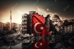
The recent severe earthquake in Turkey has caused significant suffering throughout the country. This catastrophe serves as a stark reminder that natural disasters are far from ordinary occurrences. It is essential for us to learn and grow from each experience, not only within the affected country but also on a global scale. The article discusses Turkey’s earthquake history and how the nation has implemented lessons learned from past events. This analysis highlights the importance of continuous learning in order to better prepare for and respond to such disasters.

Introduction to Turkey’s seismic history

Turkey, a country bordering Europe and Asia, has suffered earthquakes before. It is incredibly vulnerable to these disasters because of its location on the seismically active Anatolian Plate. Turkey has historically seen some of the most damaging earthquakes in the world. Understanding the nation’s seismic history and drawing from its experiences can teach other countries valuable lessons on preparing for and responding to earthquakes.

A better understanding of how to predict, prepare for, and respond to these catastrophes has been made possible by the terrible impacts of earthquakes on Turkey. The country’s response plans have improved, using new engineering innovations and construction techniques to reduce casualties and property damage. In this post, we will examine Turkey’s seismic past, the significance of Adobe architecture there, and the lessons we can draw from Turkey to improve our readiness for and response to earthquakes.

Understanding earthquakes: Causes and types

Energy is released during the shifting and grinding of tectonic plates, which results in earthquakes. Large plates that make up the Earth’s crust are constantly moving and can collide, divide, or slide past one another, which can cause the ground to shake. Tectonic, volcanic, and induced earthquakes are the three main categories of earthquakes. The movement of the Earth’s plates causes the most frequent earthquakes, known as tectonic earthquakes. While induced earthquakes are brought on by human activity, like the mining of natural resources or the construction of huge reservoirs, volcanic earthquakes are brought on by the flow of magma beneath the Earth’s surface.

The Anatolian Plate, which is being compressed between the Eurasian and Arabian Plates, is Turkey’s leading cause of seismic activity. This tectonic activity has created numerous fault lines nationwide, making it vulnerable to earthquakes. For instance, the North Anatolian Fault, a strike-slip fault with a length of more than 1,000 kilometers, has caused multiple disastrous earthquakes in Turkey’s history.

The Significance of Adobe Structures in Turkey

Turkish architecture has long used adobe constructions built of soil mixed with straw or other organic materials. These constructions, frequently seen in rural locations, have served as fortifications, houses, and public facilities. The key benefits of Adobe structures are their affordability, simplicity, and great thermal qualities, which assist in maintaining a comfortable interior temperature all year round.

However, regarding seismic activity, Adobe constructions also suffer from serious drawbacks. These structures are particularly prone to collapsing during earthquakes because of their weight and low tensile strength. Throughout Turkey’s history, many large earthquakes have painfully illustrated this susceptibility, resulting in the death of countless people and extensive destruction.

Due to this, Turkey’s rising focus is on enhancing the seismic performance of Adobe structures. Researchers and engineers have been working on developing innovative techniques and materials to increase the earthquake resistance of these traditional structures and preserve their cultural relevance while ensuring the safety of their occupants’ safety.

Major earthquakes in Turkey’s history and their impact

Throughout its history, Turkey has been the site of many large earthquakes, some of which have had devastating effects. The Erzincan earthquake in 1939, the Izmit earthquake in 1999, and the Van earthquake in 2011 are three of the most famous. These seismic occurrences resulted in extensive property damage and fatalities and changed the nation’s strategy for earthquake preparedness and response.

Approximately 33,000 people perished in the 7.9-magnitude earthquake that struck Erzincan in 1939, and many more were injured or left homeless. This catastrophe made it clear that better seismic monitoring, prediction, and earthquake-resistant building techniques are required.

With nearly 17,000 fatalities and more than 50,000 injuries, the 1999 Izmit earthquake, which registered a 7.6 on the Richter scale, was among the deadliest and most catastrophic in modern Turkish history. The significant destruction brought on by this incident highlights the significance of strengthening earthquake preparedness and response strategies.

The most recent earthquake, the 7.1 magnitude Van earthquake in 2011, significantly damaged the Adobe structures in the area, killing over 600 people and displacing thousands more. This catastrophe also emphasized the necessity for improvements in construction methods and supplies for Adobe to improve its seismic performance.

Earthquake preparedness: What we can learn from Turkey

Turkey’s earthquake experiences have taught the country important lessons about preparedness. Adopting strict building regulations that account for seismic risks is crucial to earthquake preparedness. Turkey has made tremendous progress in this area; as of present, the country’s building codes demand that buildings be built resistant to earthquakes.

The creation and upkeep of early warning systems is vital to earthquake preparedness. Turkey has made significant investments in seismic monitoring and early warning systems, which can give locals crucial information in the minutes before an earthquake. By giving people enough time to take refuge or flee dangerous structures, this early warning can help save lives and reduce damage.

Finally, vital elements of earthquake preparedness are public awareness and education. Turkey has put a lot of effort into informing its inhabitants about the dangers of earthquakes and the essential safety measures to follow in the case of one. These are examples of regular earthquake exercises in schools, public awareness campaigns, and the distribution of earthquake safety informational materials.

Building earthquake-resistant Adobe structures

Several important regions have been the focus of efforts to increase the seismic performance of Adobe structures in Turkey. To strengthen their tensile strength and earthquake resistance, old Adobe buildings have been reinforced with contemporary materials like steel or concrete. Concrete columns, reinforced Adobe bricks, or the installation of steel reinforcement bars can all be used to achieve this.

Another strategy is the creation of fresh construction methods that more evenly disperse seismic pressures across the building. Using adaptable hardwood frameworks, using seismic-resistant design concepts, or using cutting-edge materials like fiber-reinforced Adobe are a few examples of how to do this.

Turkish scientists and engineers are also looking into the possibility of enhancing the earthquake resistance of Adobe constructions by employing locally derived ecological materials. This includes using natural fibers to increase the tensile strength of Adobe bricks, such as hemp or straw.

Effective earthquake response strategies in Turkey

The tactics used in Turkey to respond to earthquakes have also been informed. The quick deployment of rescue teams to find and aid stranded or injured people is crucial to an effective earthquake response. Specialized search and rescue squads in Turkey have received funding for training and equipment, and they are frequently among the first to arrive in earthquake-affected areas.

The provision of temporary housing and other services to displaced populations is a vital component of the earthquake response. Turkey has established an effective system for disaster response, including pre-stocked emergency supplies and temporary housing that can be quickly distributed to impacted communities after an earthquake.

Finally, effective earthquake response requires coordinated efforts from national and local governments, non-governmental organizations, and international partners. In the wake of significant earthquakes, Turkey has shown the usefulness of such cooperation, with international aid frequently playing an essential part in the nation’s rebuilding efforts.

Public awareness and education on earthquake preparedness

As informed populations are more prepared to respond to devastating disasters, public awareness, and education are essential to earthquake preparedness. The dissemination of educational materials, public awareness campaigns, and integration of earthquake safety education into school curricula are just a few of Turkey’s steps to increase general understanding regarding earthquake preparedness and response.

The “Safe School Program” is one significant part of Turkey’s public awareness campaigns. Schools are assessed for their capacity to withstand earthquakes as part of this program, and any necessary adjustments are made to protect the safety of students and staff in the event of an earthquake. Regular earthquake exercises are another curriculum feature that aids in preparing children and teachers for seismic occurrences.

International Collaboration for earthquake preparedness and Response

Because earthquakes are worldwide in scope, successful earthquake preparedness and response depend on international cooperation. The establishment of uniform building norms, the exchange of seismic monitoring data, and the provision of aid for disaster response are just a few of the ways that Turkey has actively participated in worldwide initiatives to increase earthquake resilience.

The World Housing Encyclopedia, which attempts to offer details on the seismic performance of structures worldwide, is a key endeavor in this area. Turkey has contributed to this effort by offering important information on the seismic performance of its conventional Adobe structures.

Building a resilient future for Turkey and Beyond

Turkey’s earthquake experiences taught us essential lessons about preparedness and response. Turkey has made tremendous progress in lessening the effects of earthquakes on its population by enacting strict construction rules, creating early warning systems, and improving public awareness about earthquake safety.

Researchers and engineers are looking for new methods and materials to increase the seismic performance of conventional Adobe structures in Turkey, which is a continuous effort. These initiatives could significantly impact earthquake-prone areas worldwide where traditional building materials and techniques are still widely used.

Finally, increasing earthquake resilience globally requires global cooperation and knowledge sharing. By cooperating, nations can benefit from one another’s experiences and create plans to lessen the effects of earthquakes on their populations.

To sum up, Turkey’s seismic past warns about the significance of earthquake preparedness and reaction. We can create a more resilient future for ourselves and future generations by implementing the lessons discovered from Turkey’s experiences in our communities.

Day_176: Empowering Pacific Island Countries: Innovative Strategies for a Disaster-Resilient Future


Let’s learn about disaster risk reduction in Pacific Island countries.

For Pacific Island countries (PICs), which are vulnerable to climate change and natural disasters, including tropical cyclones, earthquakes, tsunamis, and volcanic eruptions, disaster risk reduction (DRR) is a crucial part of sustainable development. These occurrences could severely impact the environment, the local economy, and the local communities. It is now more crucial than ever for PICs to concentrate on improving their capacity for disaster risk reduction and resilience.

The concept and practice of disaster risk reduction (DRR) are described by the United Nations Office for Disaster Risk Reduction (UNDRR) as “the concept and practice of reducing disaster risks through systematic efforts to analyze and manage the causal factors of disasters, including through reduced exposure to hazards, lessened vulnerability of people and property, wise management of land and the environment, and improved preparedness for adverse events.” This entails comprehending the particular difficulties that PICs confront in the Pacific region, figuring out the best ways to deal with these difficulties, and cooperating to secure a more resilient future for everyone.

This article discusses how crucial disaster risk reduction is for the Pacific region, looks at essential tactics for improving DRR, looks at examples of effective programs, and thinks about how local knowledge and global cooperation may help create a resilient culture. Pacific Island countries may lessen their susceptibility, promote sustainable development, and be better prepared for future calamities by implementing these measures.

Pacific Island countries face distinct challenges that are unique to their region.

Pacific Island countries have many specific difficulties when it comes to reducing the risk of disasters. First and foremost, they are particularly vulnerable to disasters because of their location. PICs are vulnerable to volcanic eruptions, earthquakes, and tsunamis because of their location along the Pacific Ring of Fire. The area is also frequently affected by tropical cyclones, which can result in extensive harm and destruction.

PICs’ low resources, disaster preparedness, and response capacity present another critical obstacle. Many of these nations’ inhabitants, infrastructure, and financial resources are modest. As a result, they frequently struggle to create and keep up with the required structures and methods for efficient disaster risk reduction.

Additionally, the effects of climate change are increasing already-existing threats and developing new ones for Pacific Island nations. Natural disasters are becoming more frequent and severe in the area due to rising sea levels, rising temperatures, and altering weather patterns. This makes improving disaster risk reduction in the Pacific much more complex and urgent.

Reducing the risk of disasters in the Pacific region is paramount.

It is impossible to exaggerate the significance of disaster risk reduction in the region of the Pacific. Natural disasters can wreak havoc and create great destruction, affecting the environment, the economy, and communities that persist for years. The Pacific island countries can lessen these effects, save lives, and safeguard their development achievements by investing in disaster risk reduction.

The Pacific region’s Sustainable Development Goals (SDGs) are also strongly related to disaster risk reduction. Natural disasters can directly influence many SDGs, including eradicating poverty, ensuring health and well-being, and fostering sustainable cities and communities. Pacific Island countries may advance toward these objectives and guarantee a more sustainable future for all by improving their capacity for disaster risk reduction.

Finally, reducing the risk of disasters is essential to helping Pacific Island communities become resilient. Communities’ capacity to resist shocks and pressures like disasters, recover from them, and adapt to them is called resilience. By implementing efficient disaster risk reduction initiatives, PICs may empower their communities to increase their resilience and preparedness for future catastrophes.

Discover some highly effective techniques to enhance disaster risk reduction with the following suggestions:.

Climate change adaptation

The effects of climate change are one of the biggest obstacles to disaster risk reduction that Pacific Island countries must overcome. As a result, any DRR strategy in the area must include adaptation to climate change as a critical element. Some examples of adaptation methods are enhancing coastal defenses, implementing sustainable land- and water-management practices, and creating climate-resilient agriculture and fisheries.

Climate factors must be incorporated into development planning and decision-making processes as part of climate change adaptation. This can help ensure that investments and development initiatives are created to resist climate change’s effects and not unintentionally raise the risk of disaster.

Infrastructure resilience

Improving infrastructure resilience is crucial for boosting disaster risk reduction in the Pacific. This entails ensuring that critical infrastructure, such as transportation networks, energy production facilities, and water and sanitation systems, is planned, constructed, and maintained to withstand the effects of natural disasters and climate change.

Developing and enforcing construction rules and standards, using cutting-edge technologies and materials, and integrating risk assessments and management strategies into the planning and design processes for infrastructure are all ways to increase its resilience. Pacific Island countries can lessen the potential harm brought on by disasters and assure the ongoing provision of critical services both during and after disasters by investing in resilient infrastructure.

Early warning systems

Implementing efficient early warning systems is paramount in enhancing disaster risk reduction efforts in the Pacific region. The aforementioned systems can provide precise and prompt data regarding imminent perils, enabling communities and governing bodies to undertake suitable measures to mitigate the consequences of disasters.

Early warning systems encompass a variety of technologies and methodologies, including but not limited to satellite-based monitoring, seismometers, and community-based observation networks. Apart from the development and execution of stated systems, it is crucial to guarantee that communities possess the ability and knowledge to understand and respond to early warning information.

Community engagement and Preparedness

Any practical disaster risk reduction approach must include community involvement and preparedness. Pacific Island countries may ensure that local needs and views are considered and that communities have a greater capacity to respond to and recover from disasters by involving communities in designing, implementing, and monitoring DRR programs.

Creating community early warning systems and carrying out of regular disaster exercises are examples of community-based disaster preparedness initiatives. Additionally, community participation can increase the efficacy and support for DRR activities by fostering trust between citizens and authorities.

Case studies of successful disaster risk reduction initiatives

The successful implementation of various disaster risk reduction efforts in Pacific Island countries has shed light on practical methods for strengthening DRR in the area. The Pacific Catastrophe Risk Assessment and finance project (PCRAFI), which emerged in response to the expanding demand for disaster risk finance in the Pacific, is one such project.

Participating countries have access to catastrophe risk models, financial safety nets, and technical assistance for disaster risk management through PCRAFI. With the tools and resources it offers, the project has proven to be a highly successful means of assisting Pacific Island countries to identify and manage their disaster risk.

The Pacific Climate Change and Migration (PCCM) project, which intends to raise the resilience of vulnerable populations in Fiji and Tuvalu to the effects of climate change, including displacement and migration, is another effective program. The project has concentrated on a variety of interventions, such as the building of climate-resilient infrastructure, the promotion of community-based disaster risk reduction, and the development of sustainable methods for livelihood.

The PCCM project highlights the value of tackling the underlying factors that increase disaster risk, such as climate change and incorporating disaster risk reduction (DRR) into larger development projects. Pacific Island countries may create more resilient and sustainable populations by approaching disaster risk reduction strategically.

The Role of international cooperation in disaster risk reduction

Effective disaster risk reduction in the Pacific region requires global cooperation. International cooperation and support are crucial because many Pacific Island countries lack the resources and capacity to manage their disaster risk independently.

International cooperation can take many forms, including knowledge sharing, capacity building, and financial and technical support. For instance, the United Nations Development Programme (UNDP) has generously supported initiatives in the Pacific to reduce disaster risk, such as creating early warning systems, establishing community-based disaster preparedness programs, and promoting climate change adaptation.

Incorporating regional expertise and customs into DRR activities can be significantly aided by international cooperation. International partners can contribute to ensuring that DRR strategies are practical and culturally appropriate by collaborating closely with local communities and traditional leaders.

Incorporating local knowledge and traditional practices

Initiatives for reducing the risk of disaster must incorporate local expertise and customs to be effective and long-lasting. The inhabitants of the Pacific Islands have abundant knowledge and experience in dealing with natural disasters, and their customs and traditions can offer essential insights into efficient DRR techniques.

Many Pacific Island societies, for instance, have created complex early warning systems using their understanding of the environment and natural occurrences. Countries in the Pacific Islands can improve their capacity for disaster preparedness and response by integrating these systems into more comprehensive DRR policies.

Culturing climate-resilient crops and constructing cyclone-resistant homes are examples of traditional practices that can offer important insights into effective adaptation strategies. Pacific Islander countries may create more resilient and sustainable communities by recognizing and adopting these practices into DRR projects.

Building a Culture of Resilience in Pacific Island Communities

Effective disaster risk reduction in Pacific Island communities depends on fostering a culture of resilience. This entails implementing efficient DRR measures and giving communities the tools they need to manage their risk of disasters and increase their resilience.

Communities can be empowered to actively participate in disaster preparedness and response through community-based approaches to disaster risk reduction, such as those used in the PCCM project. These techniques can also assist in fostering trust and collaboration between communities and authorities.

Furthermore, building a culture of resilience in Pacific Island communities can be facilitated by raising awareness and educating people about disaster risk reduction. Pacific Island countries may create more resilient communities and lessen the potential effect of natural disasters by giving populations the expertise and skills they need to understand and handle their disaster risk.

Monitoring and evaluating disaster risk reduction progress

Monitoring and assessing their progress is crucial for disaster risk reduction strategies to be effective and persistent. Pacific Island countries can continuously hone and enhance their DRR strategies, enhancing their capacity for resilience over time by monitoring progress and identifying areas for improvement.

The development of data management systems, setting up surveys and evaluations, and establishing performance indicators are just a few examples of the various ways that monitoring and evaluation can be carried out. Pacific Island governments may ensure that their DRR projects are based on evidence and successful by investing in these tools and procedures.

Envisioning a Robust and Sustainable Future for Pacific Island Nations through Collaborative Endeavors and Holistic Strategies

It takes a variety of tactics and approaches to effectively increase disaster risk reduction in Pacific Island countries. Pacific Island countries may build a more robust future for all people by emphasizing infrastructure resilience, early warning systems, community participation and preparedness, and incorporating indigenous knowledge and traditional practices.

Effective disaster risk reduction in the Pacific requires global cooperation and encouraging a resilient culture. Pacific Island nations can lessen their susceptibility to natural disasters and promote sustainable development by cooperating and strengthening local populations.

Monitoring and evaluation will be crucial to ensuring that DRR projects in the area are successful and long-lasting. By continuously enhancing and upgrading our methods, we can create a more resilient and prosperous future for Pacific Island nations and their populations.

Day_174: (Revised) Unraveling the Twister Mysteries: A Captivating Dive into the Science of Tornadoes


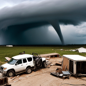
Tornadoes rank among nature’s most formidable forces, with potential wind speeds exceeding 300 miles per hour and wreaking havoc on homes, businesses, and communities. This piece delves into the atmospheric dynamics leading to tornado formation and the ongoing research enhancing our comprehension of these violent weather phenomena.

Formation and Conditions

Tornado genesis stems from specific atmospheric conditions—namely, the collision of warm, moist air from the Gulf of Mexico with cold, dry air from Canada, fostering unstable conditions ripe for severe thunderstorms. Within these storms, varying wind speeds and directions at different altitudes (wind shear) play a pivotal role, promoting the air column’s rotation and eventual condensation into a tornado.

Structure and Measurement

A tornado’s anatomy features a rotating air column, or vortex, visible as a funnel-shaped cloud laden with debris. Their intensity is gauged using the Enhanced Fujita Scale, ranging from EF0 (weakest) to EF5 (strongest), based on inflicted damage and wind speed within the vortex.

Tornado Watches vs. Warnings

Understanding the distinction is crucial for safety: a *tornado watch* signals potential tornado conditions, whereas a *tornado warning* indicates an imminent or occurring tornado, urging immediate shelter.

Safety Protocols

Preparedness involves staying informed, having a shelter plan, and knowing protective actions if caught outdoors or driving during a tornado.

Historical Impact

Historic tornadoes, such as the 1925 Tri-State Tornado and the 2011 Joplin Tornado, underscore the critical need for preparedness and awareness due to their devastating impact.

Research and Climate Change

Tornado chasing and research have enriched our understanding of tornado dynamics. Meanwhile, the potential influence of climate change on tornado patterns—including frequency, intensity, and geographic shifts—warrants ongoing study to adapt preparedness and response strategies effectively.

The intricate science behind tornadoes reveals the significance of continued research and preparedness in mitigating the impact of these awe-inspiring yet destructive storms. As our knowledge evolves, so too does our capacity to predict, prepare for, and protect against the formidable power of tornadoes.


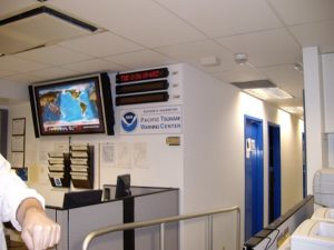
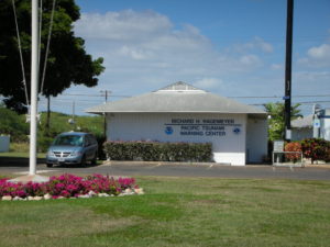
Day_171 : Past Interview Records – PTWC (Pacific Tsunami Warning Center) in Hawaii (2)

Interview Records at PTWC No. 2
2008.2.26 (Tue.) at 1000 am

The records from the interview survey are shown below.

■ Science and technology
Many models of the tsunami have been developed. However, it is difficult to adopt because it is crucial whether it is practical or not.

■ Staff training
Only internal training is available.

■ A system where Civil Defense gives warnings to citizens.
There is a hotline to the provincial government and another one to the federal government.

■ Work shift
One person is always at the center for 24 hours.
8hr-4hr-4hr 4hr 16hrs are in shift
When there is a problem, three staff gather at the center.

■ Backup
The center’s backup is at the Alaska center and if Hawaii doesn’t work,. Alaska center can cover.

■ Relationship with media
Concerning the media, media is, in a sense, a partner.
Civil Defense needs 3 hours before the event to evacuate. for that reason, there are too many time constraints. The media is fast. However, there are various restrictions. To decide to proceed with the warning or not, the media has no such authority. Also, in the United States, the media is a business and not state-owned, so it could mislead. You must always pay attention to the points.

■ Resources
Before the tsunami damage of 2004, the conditions were very limited in terms of resources. A lot of money has been invested in this field since the beginning of the year. The function of the center has been improved because of that. The staff has increased. The 2004 event was a severe tsunami disaster, letting the world know the reality.

Related information . and Books
The following tsunami warning center provides the world situations on the map and list
U.S, Tsunami Warning Centers

Day_168 : Past Interview Records – PTWC (Pacific Tsunami Warning Center) in Hawaii (1)

Continue to the past New Orleans Interview Records, I would like to open the memo about the interview to PTWC. It was a great time and I learned a lot from the interviews.  So I would like to share the fact to let you know their works to tackle the tsunami disasters in the world.

PTWC is the core center for the tsunami warning well known to the world.

2008.2.26 (Tue.) at 1000 am
15 staff, director, deputy director
Information Technician, including nine scientists
16-hour shift on 8-4-4, homes are next to the center

The records from the interview survey are shown below.

■ Evacuation
There is no international standard in terminology. Terminology varies by country/region. The words sometimes make me confused. Also, in the past, it was two either evacuation nor no evacuation.

■ Warning Error
It is challenging to give a warning. There are errors in the original earthquake and the tide data. There is an error in the gauge also.
To judge them collect is too hard. So, it can be said that 99.99% is an error.

In Hawaii, only a quarter of evacuation was actually damaged in the past. It is not unusual that although there were evacuations, there were no damages at all.

■ Past data and warning judgment
Only use a few. Because how to put out the past data, equipment, etc.are hard to do. Which way is the numerical model used to determine if the earthquake becomes a tsunami is complicated. There are more things to do.

■ Relationship with other countries
The countries that are most focused on warning about tsunami in the Pacific are Japan, America, Australia, Chile, Canada, and Russia. Also, it is not possible to evaluate the inspection records of other countries. This should be noted.

■ At the time of the 2004 tsunami
Most of the records before the Indian Ocean Tsunami were reported hourly, so judge the event was tough. Every 15 minutes, now every 6 minutes is normal and very good.

■ Conditions for cancellation
Make a comprehensive decision. The problem of reflections adds to the complexity. Not only direct waves but also an indirect wave should be considered.