Hazard」カテゴリーアーカイブ

Day_192 : What are the differences between cyclones, typhoons, and hurricanes?

The terms cyclone, typhoon, and hurricane all refer to the same meteorological phenomenon but are used in different regions of the world. They describe a large, violent tropical storm system with strong winds and heavy rain. Here are the distinctions:

  1. Cyclone is the term used in the South Pacific and Indian Oceans. The word “cyclone” is also used in a broader sense to refer to any circulating weather system over the ocean characterized by closed isobar patterns and circular wind movement, whether tropical or not. In the Indian Ocean and South Pacific, when the system reaches sustained wind speeds of at least 74 miles per hour, it is called a tropical cyclone.
  2. Typhoon is the name given to these storm systems in the Northwest Pacific Ocean, typically west of the dateline. Like hurricanes and cyclones, a typhoon forms over warm tropical oceans and gains energy. When the sustained winds in this system reach or exceed 74 miles per hour, it is officially referred to as a typhoon.
  3. Hurricane is the term used in the North Atlantic, Central, and Eastern North Pacific oceans. The criteria for being classified as a hurricane are the same as for typhoons and cyclones, with sustained wind speeds of at least 74 miles per hour.

The naming convention is primarily geographical. The structure and behavior of these storms are the same, and they all belong to the category of tropical cyclones. The difference in nomenclature does not imply a difference in the hazard or potential damage these storms can cause, which is primarily dependent on their size, strength, and the area they affect.

A condensed list of references to support the distinctions between cyclones, typhoons, and hurricanes:

  1. The World Meteorological Organization (WMO) provides official definitions and classifications for tropical cyclones, typhoons, and hurricanes based on regional basins.
  2. National Hurricane Center (NHC) and Central Pacific Hurricane Center (CPHC): Part of the United States’ National Oceanic and Atmospheric Administration (NOAA), these centers offer detailed information on hurricanes, including the distinctions between hurricanes, typhoons, and cyclones.
  3. The Australian Bureau of Meteorology (BOM) offers insights into cyclones, especially in the South Pacific and Indian Ocean regions, detailing their formation, classification, and impacts.
  4. Japan Meteorological Agency (JMA): Provides information on typhoons, their tracking, and impacts in the Northwest Pacific region.
  5. Indian Meteorological Department (IMD): Offers comprehensive data on cyclones in the Indian Ocean, including classifications and warnings.

These organizations are key in tracking, studying, and providing information on these storm systems worldwide. They use specific criteria for wind speeds, atmospheric pressure, and other factors to classify these storms according to the region they occur in.

Day_191 : The Comprehensive Guide to Understanding Droughts

Recent years have seen a substantial impact of both climate change and human activities on droughts, which are complex and multifaceted natural phenomena. Droughts are marked by prolonged periods of precipitation that fall below average, resulting in significant scarcity of water that has far-reaching consequences for economies and ecosystems worldwide. This expanded guide delves deeper into the causes of droughts, their wide-ranging impacts, and the innovative solutions needed to mitigate their effects.

Causes of Droughts

Droughts arise from a blend of natural variability and human-induced factors. Key natural causes include shifts in atmospheric circulation patterns, which can disrupt traditional weather patterns, and the ongoing challenge of global warming, which intensifies evaporation rates, reducing soil moisture and water availability. Human activities, such as deforestation, directly alter land use and local climates, further diminishing rainfall and aggravating drought conditions. Additionally, the unsustainable use of water resources and pollution significantly strain water supplies. A comprehensive understanding of these factors is essential for crafting effective and sustainable drought mitigation strategies.

The Multidimensional Impacts of Droughts

The consequences of droughts extend far beyond the immediate lack of water, affecting environmental, economic, and social spheres. Environmentally, droughts can cause severe soil degradation, loss of plant and animal life, and an increased incidence of wildfires. Economically, they can devastate agricultural productivity, leading to food scarcity, skyrocketing prices, and a decrease in energy production, especially in regions reliant on hydroelectric power. Socially, the effects of droughts can be devastating, causing displacement, heightening conflicts over dwindling resources, and exacerbating health crises due to limited water supplies. The impacts are particularly pronounced in developing nations, where agriculture forms the backbone of the economy.

Historical Context of Droughts

Historically, droughts have posed significant challenges to civilizations, with events like the Dust Bowl of the 1930s in the United States serving as stark reminders of their potential severity. Recent droughts, such as the prolonged one in California, underscore the increasing frequency and intensity of these events in the face of climate change. Studying these historical droughts offers invaluable lessons for current and future drought preparedness and response strategies.

Measuring and Monitoring Droughts

Accurately measuring and monitoring droughts is crucial for early detection and response. The Palmer Drought Severity Index (PDSI) and other metrics like soil moisture and streamflow offer insights into drought severity and progression. Advancements in remote sensing and satellite imagery provide comprehensive data on drought impacts over large areas, facilitating timely and effective mitigation efforts.

Global Drought Conditions and Responses

Droughts today impact vast regions globally, with severe conditions persisting in areas such as the Sahel in Africa, Maharashtra in India, and across Australia. These conditions call for a unified global response, integrating both traditional strategies and innovative technologies to address the multifaceted challenges of droughts.

Forward-Looking Solutions for Drought Mitigation

Sustainable water management practices are foundational to drought mitigation. Techniques like rainwater harvesting, water recycling, and the adoption of efficient irrigation methods can dramatically improve water security. Embracing drought-resistant crops and soil conservation techniques further bolsters agricultural resilience. Innovatively, solutions such as desalination and cloud seeding present promising avenues for augmenting water supplies, while genetically modified crops offer potential for enhanced drought resistance.

A Unified Call to Action

The challenge of droughts is formidable but not insurmountable. With a deep understanding of their causes and impacts, combined with a commitment to sustainable management and innovative solutions, we can confront droughts effectively. It is a collective responsibility, from policymakers to individuals, to foster a resilient and sustainable approach to water management. Together, we can ensure a water-secure future for all, safeguarding our environment, economy, and societies against the enduring challenge of droughts.

Day 179: Comprehensive Examination of “Natural” Disasters: Causes and Effects

Natural calamities arise from a combination of intricate and diverse factors, resulting in many consequences. They are frequently impacted by numerous factors, including as geographical location, climate, and human activities. Deforestation can exacerbate flooding by diminishing the soil’s capacity to absorb water. Climate change is exacerbating the intensity and recurrence of weather-related catastrophes.

The impacts of these calamities are similarly varied. Natural disasters can lead to fatalities, property damage, population displacement, infrastructure devastation, and economic decline. Additionally, they have the potential to induce enduring ecological harm, such as the degradation of soil and the depletion of habitats, which may take several decades to restore.

Analysis of a Particular The circumstances: The most devastating natural disasters worldwide

Throughout history, the global community has observed a series of profoundly catastrophic natural calamities. The 2004 Indian Ocean earthquake and tsunami was a catastrophic event that resulted in a significant loss of human life. It caused the death of more than 230,000 individuals in 14 different nations, making it one of the deadliest disasters in recorded history. The occurrence also resulted in extensive devastation, leading to the displacement of millions of individuals and the severe destruction of numerous coastal communities.
Likewise, the earthquake that occurred in Haiti in 2010 resulted in the death of over 230,000 individuals and left 1.5 million people without a house. Additionally, it resulted in significant harm to the country’s infrastructure, severely impacting its economy and posing a formidable challenge for recovery.

Day_176: Empowering Pacific Island Countries: Innovative Strategies for a Disaster-Resilient Future


Let’s learn about disaster risk reduction in Pacific Island countries.

For Pacific Island countries (PICs), which are vulnerable to climate change and natural disasters, including tropical cyclones, earthquakes, tsunamis, and volcanic eruptions, disaster risk reduction (DRR) is a crucial part of sustainable development. These occurrences could severely impact the environment, the local economy, and the local communities. It is now more crucial than ever for PICs to concentrate on improving their capacity for disaster risk reduction and resilience.

The concept and practice of disaster risk reduction (DRR) are described by the United Nations Office for Disaster Risk Reduction (UNDRR) as “the concept and practice of reducing disaster risks through systematic efforts to analyze and manage the causal factors of disasters, including through reduced exposure to hazards, lessened vulnerability of people and property, wise management of land and the environment, and improved preparedness for adverse events.” This entails comprehending the particular difficulties that PICs confront in the Pacific region, figuring out the best ways to deal with these difficulties, and cooperating to secure a more resilient future for everyone.

This article discusses how crucial disaster risk reduction is for the Pacific region, looks at essential tactics for improving DRR, looks at examples of effective programs, and thinks about how local knowledge and global cooperation may help create a resilient culture. Pacific Island countries may lessen their susceptibility, promote sustainable development, and be better prepared for future calamities by implementing these measures.

Pacific Island countries face distinct challenges that are unique to their region.

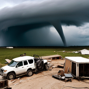
Pacific Island countries have many specific difficulties when it comes to reducing the risk of disasters. First and foremost, they are particularly vulnerable to disasters because of their location. PICs are vulnerable to volcanic eruptions, earthquakes, and tsunamis because of their location along the Pacific Ring of Fire. The area is also frequently affected by tropical cyclones, which can result in extensive harm and destruction.

PICs’ low resources, disaster preparedness, and response capacity present another critical obstacle. Many of these nations’ inhabitants, infrastructure, and financial resources are modest. As a result, they frequently struggle to create and keep up with the required structures and methods for efficient disaster risk reduction.

Additionally, the effects of climate change are increasing already-existing threats and developing new ones for Pacific Island nations. Natural disasters are becoming more frequent and severe in the area due to rising sea levels, rising temperatures, and altering weather patterns. This makes improving disaster risk reduction in the Pacific much more complex and urgent.

Reducing the risk of disasters in the Pacific region is paramount.

It is impossible to exaggerate the significance of disaster risk reduction in the region of the Pacific. Natural disasters can wreak havoc and create great destruction, affecting the environment, the economy, and communities that persist for years. The Pacific island countries can lessen these effects, save lives, and safeguard their development achievements by investing in disaster risk reduction.

The Pacific region’s Sustainable Development Goals (SDGs) are also strongly related to disaster risk reduction. Natural disasters can directly influence many SDGs, including eradicating poverty, ensuring health and well-being, and fostering sustainable cities and communities. Pacific Island countries may advance toward these objectives and guarantee a more sustainable future for all by improving their capacity for disaster risk reduction.

Finally, reducing the risk of disasters is essential to helping Pacific Island communities become resilient. Communities’ capacity to resist shocks and pressures like disasters, recover from them, and adapt to them is called resilience. By implementing efficient disaster risk reduction initiatives, PICs may empower their communities to increase their resilience and preparedness for future catastrophes.

Discover some highly effective techniques to enhance disaster risk reduction with the following suggestions:.

Climate change adaptation

The effects of climate change are one of the biggest obstacles to disaster risk reduction that Pacific Island countries must overcome. As a result, any DRR strategy in the area must include adaptation to climate change as a critical element. Some examples of adaptation methods are enhancing coastal defenses, implementing sustainable land- and water-management practices, and creating climate-resilient agriculture and fisheries.

Climate factors must be incorporated into development planning and decision-making processes as part of climate change adaptation. This can help ensure that investments and development initiatives are created to resist climate change’s effects and not unintentionally raise the risk of disaster.

Infrastructure resilience

Improving infrastructure resilience is crucial for boosting disaster risk reduction in the Pacific. This entails ensuring that critical infrastructure, such as transportation networks, energy production facilities, and water and sanitation systems, is planned, constructed, and maintained to withstand the effects of natural disasters and climate change.

Developing and enforcing construction rules and standards, using cutting-edge technologies and materials, and integrating risk assessments and management strategies into the planning and design processes for infrastructure are all ways to increase its resilience. Pacific Island countries can lessen the potential harm brought on by disasters and assure the ongoing provision of critical services both during and after disasters by investing in resilient infrastructure.

Early warning systems

Implementing efficient early warning systems is paramount in enhancing disaster risk reduction efforts in the Pacific region. The aforementioned systems can provide precise and prompt data regarding imminent perils, enabling communities and governing bodies to undertake suitable measures to mitigate the consequences of disasters.

Early warning systems encompass a variety of technologies and methodologies, including but not limited to satellite-based monitoring, seismometers, and community-based observation networks. Apart from the development and execution of stated systems, it is crucial to guarantee that communities possess the ability and knowledge to understand and respond to early warning information.

Community engagement and Preparedness

Any practical disaster risk reduction approach must include community involvement and preparedness. Pacific Island countries may ensure that local needs and views are considered and that communities have a greater capacity to respond to and recover from disasters by involving communities in designing, implementing, and monitoring DRR programs.

Creating community early warning systems and carrying out of regular disaster exercises are examples of community-based disaster preparedness initiatives. Additionally, community participation can increase the efficacy and support for DRR activities by fostering trust between citizens and authorities.

Case studies of successful disaster risk reduction initiatives

The successful implementation of various disaster risk reduction efforts in Pacific Island countries has shed light on practical methods for strengthening DRR in the area. The Pacific Catastrophe Risk Assessment and finance project (PCRAFI), which emerged in response to the expanding demand for disaster risk finance in the Pacific, is one such project.

Participating countries have access to catastrophe risk models, financial safety nets, and technical assistance for disaster risk management through PCRAFI. With the tools and resources it offers, the project has proven to be a highly successful means of assisting Pacific Island countries to identify and manage their disaster risk.

The Pacific Climate Change and Migration (PCCM) project, which intends to raise the resilience of vulnerable populations in Fiji and Tuvalu to the effects of climate change, including displacement and migration, is another effective program. The project has concentrated on a variety of interventions, such as the building of climate-resilient infrastructure, the promotion of community-based disaster risk reduction, and the development of sustainable methods for livelihood.

The PCCM project highlights the value of tackling the underlying factors that increase disaster risk, such as climate change and incorporating disaster risk reduction (DRR) into larger development projects. Pacific Island countries may create more resilient and sustainable populations by approaching disaster risk reduction strategically.

The Role of international cooperation in disaster risk reduction

Effective disaster risk reduction in the Pacific region requires global cooperation. International cooperation and support are crucial because many Pacific Island countries lack the resources and capacity to manage their disaster risk independently.

International cooperation can take many forms, including knowledge sharing, capacity building, and financial and technical support. For instance, the United Nations Development Programme (UNDP) has generously supported initiatives in the Pacific to reduce disaster risk, such as creating early warning systems, establishing community-based disaster preparedness programs, and promoting climate change adaptation.

Incorporating regional expertise and customs into DRR activities can be significantly aided by international cooperation. International partners can contribute to ensuring that DRR strategies are practical and culturally appropriate by collaborating closely with local communities and traditional leaders.

Incorporating local knowledge and traditional practices

Initiatives for reducing the risk of disaster must incorporate local expertise and customs to be effective and long-lasting. The inhabitants of the Pacific Islands have abundant knowledge and experience in dealing with natural disasters, and their customs and traditions can offer essential insights into efficient DRR techniques.

Many Pacific Island societies, for instance, have created complex early warning systems using their understanding of the environment and natural occurrences. Countries in the Pacific Islands can improve their capacity for disaster preparedness and response by integrating these systems into more comprehensive DRR policies.

Culturing climate-resilient crops and constructing cyclone-resistant homes are examples of traditional practices that can offer important insights into effective adaptation strategies. Pacific Islander countries may create more resilient and sustainable communities by recognizing and adopting these practices into DRR projects.

Building a Culture of Resilience in Pacific Island Communities

Effective disaster risk reduction in Pacific Island communities depends on fostering a culture of resilience. This entails implementing efficient DRR measures and giving communities the tools they need to manage their risk of disasters and increase their resilience.

Communities can be empowered to actively participate in disaster preparedness and response through community-based approaches to disaster risk reduction, such as those used in the PCCM project. These techniques can also assist in fostering trust and collaboration between communities and authorities.

Furthermore, building a culture of resilience in Pacific Island communities can be facilitated by raising awareness and educating people about disaster risk reduction. Pacific Island countries may create more resilient communities and lessen the potential effect of natural disasters by giving populations the expertise and skills they need to understand and handle their disaster risk.

Monitoring and evaluating disaster risk reduction progress

Monitoring and assessing their progress is crucial for disaster risk reduction strategies to be effective and persistent. Pacific Island countries can continuously hone and enhance their DRR strategies, enhancing their capacity for resilience over time by monitoring progress and identifying areas for improvement.

The development of data management systems, setting up surveys and evaluations, and establishing performance indicators are just a few examples of the various ways that monitoring and evaluation can be carried out. Pacific Island governments may ensure that their DRR projects are based on evidence and successful by investing in these tools and procedures.

Envisioning a Robust and Sustainable Future for Pacific Island Nations through Collaborative Endeavors and Holistic Strategies

It takes a variety of tactics and approaches to effectively increase disaster risk reduction in Pacific Island countries. Pacific Island countries may build a more robust future for all people by emphasizing infrastructure resilience, early warning systems, community participation and preparedness, and incorporating indigenous knowledge and traditional practices.

Effective disaster risk reduction in the Pacific requires global cooperation and encouraging a resilient culture. Pacific Island nations can lessen their susceptibility to natural disasters and promote sustainable development by cooperating and strengthening local populations.

Monitoring and evaluation will be crucial to ensuring that DRR projects in the area are successful and long-lasting. By continuously enhancing and upgrading our methods, we can create a more resilient and prosperous future for Pacific Island nations and their populations.

Day_174: (Revised) Unraveling the Twister Mysteries: A Captivating Dive into the Science of Tornadoes


Tornadoes rank among nature’s most formidable forces, with potential wind speeds exceeding 300 miles per hour and wreaking havoc on homes, businesses, and communities. This piece delves into the atmospheric dynamics leading to tornado formation and the ongoing research enhancing our comprehension of these violent weather phenomena.

Formation and Conditions

Tornado genesis stems from specific atmospheric conditions—namely, the collision of warm, moist air from the Gulf of Mexico with cold, dry air from Canada, fostering unstable conditions ripe for severe thunderstorms. Within these storms, varying wind speeds and directions at different altitudes (wind shear) play a pivotal role, promoting the air column’s rotation and eventual condensation into a tornado.

Structure and Measurement

A tornado’s anatomy features a rotating air column, or vortex, visible as a funnel-shaped cloud laden with debris. Their intensity is gauged using the Enhanced Fujita Scale, ranging from EF0 (weakest) to EF5 (strongest), based on inflicted damage and wind speed within the vortex.

Tornado Watches vs. Warnings

Understanding the distinction is crucial for safety: a *tornado watch* signals potential tornado conditions, whereas a *tornado warning* indicates an imminent or occurring tornado, urging immediate shelter.

Safety Protocols

Preparedness involves staying informed, having a shelter plan, and knowing protective actions if caught outdoors or driving during a tornado.

Historical Impact

Historic tornadoes, such as the 1925 Tri-State Tornado and the 2011 Joplin Tornado, underscore the critical need for preparedness and awareness due to their devastating impact.

Research and Climate Change

Tornado chasing and research have enriched our understanding of tornado dynamics. Meanwhile, the potential influence of climate change on tornado patterns—including frequency, intensity, and geographic shifts—warrants ongoing study to adapt preparedness and response strategies effectively.

The intricate science behind tornadoes reveals the significance of continued research and preparedness in mitigating the impact of these awe-inspiring yet destructive storms. As our knowledge evolves, so too does our capacity to predict, prepare for, and protect against the formidable power of tornadoes.


Day_163: PAR model : Hazard and Vulnerability (3)

As discussed on Day 147, now we are investing the social vulnerability index of the district, sub-district, and village levels in Ayutthaya. To calculate the social vulnerability index, exposure, susceptibility, and capacity data are examined. Notably, the district level of the index is figured out, as shown in Figure 1, using principal component analysis.

(Please enlarge the screen to see the figure well. Darker blue means more vulnerable. The detailed factors of PCA will be explained later. )

Figure 1: Social Vulnerability Index Industrial Complex Area(SVI-ICA) Ref. 1)

https://disasterresearchnotes.site/archives/3746

As mentioned above, the district level of the social vulnerability index can be figured out by statistical data. However, sub-district and village levels data are challenging to collect. We also need to understand the capacity is a factor that includes not only hard but also soft countermeasures against natural disasters, as discussed before. Especially, capacity-soft is not stable by time with circumstances and could be changing from time to time. The stats data is not enough to indicate their actual capacities.

Based on the above fact, the capacity assessment is considered to fill the gaps. The capacity assessment method was based on the FDPI project experience.

The population of the target areas is indicated below:

Table 1:  The Population of the Tambons (Source: registration office 2019)

Below is the category (indicators) to measure the capacity.

Table 2: Indicators and Sub-Indicators for Capacity Assessment

The results are as indicated in Figure 2.

Figure 2: Four Sub-District Capacity Assessment 

The findings show the western side and eastern side have a big gap, as you can see in Figure 2.

Figure 3 explains the education and training part is much different among the four target sub-district. The results mean we can monitor and evaluate their progress after we provide education, training, system, or so on there.

Figure 3: Capacity Assessment Analyses

For example, each sub-indicators are examined as follows:

Figure 4: Information and Education Sub-Indicators Gaps 

The analyses (the detailed sub-indicators from IE1 to IE11) will be explained later.

Related Book and Info.

At Risk: Natural Hazards, People’s Vulnerability and Disasters

*This is the baseline research for the SATREPS project.

Day_159: PAR model : Hazard and Vulnerability (2)

http://disasterresearchnotes.site/archives/3746

As discussed on Day 147, now we are investing the social vulnerability index of the district, sub-district, and village levels in Ayutthaya. To calculate the social vulnerability index, exposure, susceptibility, and capacity data are examined. Especially, the district level of the index is figured out as shown in Figure 1 using principal component analysis.

Figure 1: Social Vulnerability Index Industrial Complex Area(SVI-ICA) Ref. 1)

The district level of the social vulnerability index can be figured out by statistical data. However, sub-district and village level data should be difficult to collect such data. Based on the fact, the capacity assessment is firstly conducted to the target four sub-districts as indicated in Figure 2. The capacity assessment method was based on the FDPI project experience.

Figure 2: Four Sub-District Capacity Assessment 

The findings say the western side and eastern side have a big gap as you can see in Figure 2.

Figure 3 indicates the education and training part is much different among the four target sub-district. This means we can monitor and evaluate their progress after we provide education, training, system, or so on there.

Figure 3: Capacity Assessment Analyses

The detailed examination will be explained later.

*Exposure, Susceptibility, and Capacity data list will be shown later. The theoretical frame is base on the PAR model. The below book can be referred.


At Risk: Natural Hazards, People’s Vulnerability and Disasters

**This is the baseline research for the SATREPS project.

Ref. 1) Tadashi Nakasu, Ruttiya Bula-or, Sutee Anatsuksomsti, Korrakot Positlimpakul (2019)Social Vulnerability Changes and Sustainable Development in the Flooded Industrial Complex Area The 2nd multidisciplinary International Conference on Humanities (ICH 2019) “Innovation and Transformation in Humanities for a Sustainable Tomorrow.” 30-31 October 2019, School of Humanities, Universiti Sains Malaysia, Penang, Malaysia

Day_147: PAR model : Hazard and Vulnerability

Disaster researchers often refer to the PAR (Press and Release) model to understand the risk.
The PAR model was described in the book “At Risk”. This book is a kind of bible for disaster researchers. Disaster Risk is described as an overlapped area between Hazard and Vulnerability.


The Disaster risk should also consider “Exposure” and “Capacity”. The capacity has mainly two parts, Hard and Soft. In short, Capacity Hard (CH) means tangible factors and  Capacity Soft(CS) means intangible ones. For instance, infrastructure is CH and education is CS. The Disaster risk usually can be identified by the following picture. Figure 1 indicates the above.


Figure 1  Disaster Risk

Using the below equation, disaster risk would be identified.

Disaster Risk = H*E*V/ (CH+CS)

Each factor such as E (Exposure) could be identified by mainly statistic data in the target area.
To do this, the indices can be established. The data to contribute each factor should be carefully examined.

Figure 2 is the national level Index Image of Thailand.


Figure 2 Social Vulnerability

To be continued…..