Tsunami」カテゴリーアーカイブ

Day_83 : Tsunami – the words

80% ofall tsunamis occurring in the world are concentrated in the Circum-Pacific Belt.The leading countries researching the tsunami are Japan, the U.S., and Russia. The tsunami is originally a Japanese term that means a high tidal wave. The name was used by Japanese immigrants during a tidal wave caused by the 1946 Aleutian Islands earthquake (tsunami) hit in Hiro, Hawaii and it became an international word, especially an academic word, ”Tsunami”. The International Union of Geodesy and Geophysics (IUGG) is in charge of a tsunami session at the start of an international conference about tsunamis. Tsunami” became public after the 2004 Indian Ocean Tsunami disaster.

*The word “tsu is composed of the Japanese words “Tsu” (which means harbor) and “Nami” (which means “wave”)(ITIC)

The 1946 Aleutian Islands earthquake
Hiro, 1964

***Pacific Tsunami Museum in Hiro

Day_203 : Distant Tsunamis Triggered by Massive Earthquakes: The 1960 Chilean Earthquake and the 2004 Indian Ocean Tsunami

On the early morning of May 23, 1960, a massive earthquake, the largest ever recorded with a magnitude of 9.5, struck southern Chile. This earthquake unleashed a tsunami that swiftly crossed the Pacific Ocean, reaching the Japanese coast about 22.5 hours later. The tsunami, which surged up to 8 meters high, resulted in 139 deaths and caused the destruction or displacement of 2,830 buildings across Japan. Due to the geographical position of Chile opposite Japan, the tsunami’s impact was more pronounced upon reaching the Japanese shores. These distant tsunamis are particularly challenging to forecast since they occur without the preliminary tremors typically associated with earthquakes. Consequently, regions prone to seismic activity, particularly around the Pacific, including Hawaii, have established early warning systems.

Day_168 : Past Interview Records – PTWC (Pacific Tsunami Warning Center) in Hawaii (1)


In 2004, the Indian Ocean was struck by another significant earthquake, which triggered a devastating tsunami. At that time, the absence of a tsunami warning system in the Indian Ocean contributed to a staggering death toll of 300,000. The effectiveness of tsunami warnings is limited by their ability to reach extensive coastal areas promptly. Therefore, it is crucial for residents to be aware of their local environmental characteristics and rely on personal judgment and preparedness to mitigate the risks posed by tsunamis.

Day_200 : High-Speed Tsunamis and Delayed Warnings: The Urgency of Evacuation during the 1896 Meiji Sanriku, 1933 Showa Sanriku, and 2011 Great East Japan Earthquake and Tsunamis

Large tsunamis are caused by major earthquakes of magnitude 8 or greater. In particular, such earthquakes frequently occur along the Pacific coast of Hokkaido and Tohoku in Japan. The Sanriku coast in this region has a special shape called a “rias coast,” which is prone to tsunamis. In the 1896 Meiji Sanriku tsunami, the tsunami reached a height of 38 meters and killed about 22,000 people. Thirty-seven years later, in 1933, another major tsunami, the Showa Sanriku tsunami, struck the region, killing approximately 3,000 people. 2011’s Great East Japan Earthquake and Tsunami did not fully apply the lessons of the past, leaving approximately 18,000 people dead or missing.

The time between an earthquake and a tsunami reaching the coast is very short, from 5 to 10 minutes. Running to higher ground within this short time is almost the only way to protect yourself from a tsunami. The tsunami will reach the coast where it is the highest, and the tsunami will also reach the coast the fastest. Therefore, instead of waiting for information from the outside, it is important to have your own knowledge about tsunamis, understand your surroundings, and act on your own judgment.

Contents (in Japanese)
Source: URL:https://dil.bosai.go.jp/workshop/2006workshop/gakusyukai21.html

Day_194 : Tsunami Up and Down

When a large earthquake occurs at the bottom of the ocean, the ground suddenly lifts and sinks. This movement directly affects the surface of the ocean, creating large waves that spread far and wide. This is the typical way an earthquake-induced tsunami starts. Smaller earthquakes do not cause tsunamis because the shape of the ocean floor does not change much. Also, if an earthquake occurs very deep in the ocean, tsunamis do not occur because their effects do not reach the surface of the ocean. Large tsunamis are caused by huge earthquakes in deep ocean trenches, which are caused by the subduction of the Earth’s plates. In this type of earthquake, the ocean surface is pushed up or pulled down. On the side where the ocean is pushed up, the waves rise; on the side where it is pulled down, the ocean lowers. Which of the two is the first wave of a tsunami has a lot to do with how you perceive the danger and how you escape; the nature of the tsunami that hit Sumatra in 2004 (magnitude 9.0) caused the southern part of Thailand to be hit by a wave that pulled the ocean down, and the nature of this tsunami increased the damage.

Day_71: The Tsunami history in Tohoku : 1896 Meiji sanriku tsunami

The Great East Japan Earthquake and Tsunami (GEJET) disaster is the deadliest disaster after the Second World War in Japan. The earthquake happened at 2:46 p.m. on March 11th, 2011. The total casualty number is 19,846 based on the EM-DAT. The maximum . tsunami height is 40m on the Sanriku Ria Coast. The first wave arrives approximately 30 minutes  after the earthquake.

The Sanriku areas have a special geographical condition mentioned as the Sanriku Ria Coast. The coast has mountains close to the sea, so residential areas are limited only in the narrow and lower zones near the sea, and the areas become very vulnerable against the tsunamis. The bays on the coast are small, and the sea inside the bays is very deep. This makes tsunamis faster and higher, which is why the Sanriku Ria Coast has the highest tsunami risk area in the world.

Because of these characteristics, the communities on the Sanriku Ria coast, mainly in Iwate prefecture, have historically been severely affected by tsunami disasters such as the Meiji Sanriku Tsunami (1896), Sowa Sanriku Tsunami (1933), and Chilean Earthquake Tsunami (1960), compared to the flat coast mainly in Miyagi prefecture and other areas in Japan.

I will explain a little bit about the Meiji (1896). This disaster is so-called a surprise attack. The tsunami disaster happened at approximately . 7:30 p.m. on June 15, 1896, mainly on the Sanriku Ria coast. The dead and missing number has been reported at over 22,000. The earthquake is not so strong (the Japanese earthquake scale indicates Shindo 1-2); however, the tsunami is very strong and high (the maximum height is 38.2m in the Ayasato area (present-day Ofunato city)) compared to the earthquake movement scale. This has severe impacts.We call this huge tsunami caused by a weak earthquake Tsunami Earthquake. The first wave arrives approximately 35 meters after the earthquake. The Meiji (1896) has been the worst tsunami disaster ever in Japan.

In 1611, the larger tsunami (Keicho Sanriku Tsunami*) than Meiji hit the Sanriku area. That could also be a “tsunami earthquake.” After that, every 40 years, the people in the area tended to have a big tsunami. Even though they had such experiences, they did not have good tsunami disaster countermeasures, and the tsunami was a “tsunami earthquake.” In addition, they had some ancient traditions, like the idea that a tsunami was a punishment from the gods and Buddha. These are the main causes that made the Meiji worse.

Keicho Sanriku Tsunami
https://en.wikipedia.org/wiki/1611_Sanriku_earthquake

The Kyodo news company has obtained the pictures on the Meiji (1896)


Day_183: Introduction of Understanding Earthquakes

Earthquakes, being a natural phenomena, have generated both attraction and fear among people worldwide. We are aware of earthquakes leading to enormous devastation, fatalities, property damage, and potentially initiating tsunamis. Despite the numerous technological developments, earthquakes remain unpredictable and have the potential to occur at any given moment and location.

An earthquake is the result of a sudden slip between two blocks of the earth’s crust, which leads to the release of energy in the form of seismic waves. Seismic waves propagate through the Earth’s crust and can be monitored by devices known as seismometers. Earthquakes occur in various regions of the planet, encompassing terrestrial areas, subaquatic environments, and even within the earth’s mantle. The seismic intensity of an earthquake is quantified using the Richter scale, which spans from 1 to 10.

Earthquakes result from a multitude of sources, encompassing tectonic plate displacement, volcanic eruptions, and even anthropogenic operations like mining and drilling.

Day 179: Comprehensive Examination of “Natural” Disasters: Causes and Effects

Natural calamities arise from a combination of intricate and diverse factors, resulting in many consequences. They are frequently impacted by numerous factors, including as geographical location, climate, and human activities. Deforestation can exacerbate flooding by diminishing the soil’s capacity to absorb water. Climate change is exacerbating the intensity and recurrence of weather-related catastrophes.

The impacts of these calamities are similarly varied. Natural disasters can lead to fatalities, property damage, population displacement, infrastructure devastation, and economic decline. Additionally, they have the potential to induce enduring ecological harm, such as the degradation of soil and the depletion of habitats, which may take several decades to restore.

Analysis of a Particular The circumstances: The most devastating natural disasters worldwide

Throughout history, the global community has observed a series of profoundly catastrophic natural calamities. The 2004 Indian Ocean earthquake and tsunami was a catastrophic event that resulted in a significant loss of human life. It caused the death of more than 230,000 individuals in 14 different nations, making it one of the deadliest disasters in recorded history. The occurrence also resulted in extensive devastation, leading to the displacement of millions of individuals and the severe destruction of numerous coastal communities.
Likewise, the earthquake that occurred in Haiti in 2010 resulted in the death of over 230,000 individuals and left 1.5 million people without a house. Additionally, it resulted in significant harm to the country’s infrastructure, severely impacting its economy and posing a formidable challenge for recovery.

Day_176: Empowering Pacific Island Countries: Innovative Strategies for a Disaster-Resilient Future


Let’s learn about disaster risk reduction in Pacific Island countries.

For Pacific Island countries (PICs), which are vulnerable to climate change and natural disasters, including tropical cyclones, earthquakes, tsunamis, and volcanic eruptions, disaster risk reduction (DRR) is a crucial part of sustainable development. These occurrences could severely impact the environment, the local economy, and the local communities. It is now more crucial than ever for PICs to concentrate on improving their capacity for disaster risk reduction and resilience.

The concept and practice of disaster risk reduction (DRR) are described by the United Nations Office for Disaster Risk Reduction (UNDRR) as “the concept and practice of reducing disaster risks through systematic efforts to analyze and manage the causal factors of disasters, including through reduced exposure to hazards, lessened vulnerability of people and property, wise management of land and the environment, and improved preparedness for adverse events.” This entails comprehending the particular difficulties that PICs confront in the Pacific region, figuring out the best ways to deal with these difficulties, and cooperating to secure a more resilient future for everyone.

This article discusses how crucial disaster risk reduction is for the Pacific region, looks at essential tactics for improving DRR, looks at examples of effective programs, and thinks about how local knowledge and global cooperation may help create a resilient culture. Pacific Island countries may lessen their susceptibility, promote sustainable development, and be better prepared for future calamities by implementing these measures.

Pacific Island countries face distinct challenges that are unique to their region.

Pacific Island countries have many specific difficulties when it comes to reducing the risk of disasters. First and foremost, they are particularly vulnerable to disasters because of their location. PICs are vulnerable to volcanic eruptions, earthquakes, and tsunamis because of their location along the Pacific Ring of Fire. The area is also frequently affected by tropical cyclones, which can result in extensive harm and destruction.

PICs’ low resources, disaster preparedness, and response capacity present another critical obstacle. Many of these nations’ inhabitants, infrastructure, and financial resources are modest. As a result, they frequently struggle to create and keep up with the required structures and methods for efficient disaster risk reduction.

Additionally, the effects of climate change are increasing already-existing threats and developing new ones for Pacific Island nations. Natural disasters are becoming more frequent and severe in the area due to rising sea levels, rising temperatures, and altering weather patterns. This makes improving disaster risk reduction in the Pacific much more complex and urgent.

Reducing the risk of disasters in the Pacific region is paramount.

It is impossible to exaggerate the significance of disaster risk reduction in the region of the Pacific. Natural disasters can wreak havoc and create great destruction, affecting the environment, the economy, and communities that persist for years. The Pacific island countries can lessen these effects, save lives, and safeguard their development achievements by investing in disaster risk reduction.

The Pacific region’s Sustainable Development Goals (SDGs) are also strongly related to disaster risk reduction. Natural disasters can directly influence many SDGs, including eradicating poverty, ensuring health and well-being, and fostering sustainable cities and communities. Pacific Island countries may advance toward these objectives and guarantee a more sustainable future for all by improving their capacity for disaster risk reduction.

Finally, reducing the risk of disasters is essential to helping Pacific Island communities become resilient. Communities’ capacity to resist shocks and pressures like disasters, recover from them, and adapt to them is called resilience. By implementing efficient disaster risk reduction initiatives, PICs may empower their communities to increase their resilience and preparedness for future catastrophes.

Discover some highly effective techniques to enhance disaster risk reduction with the following suggestions:.

Climate change adaptation

The effects of climate change are one of the biggest obstacles to disaster risk reduction that Pacific Island countries must overcome. As a result, any DRR strategy in the area must include adaptation to climate change as a critical element. Some examples of adaptation methods are enhancing coastal defenses, implementing sustainable land- and water-management practices, and creating climate-resilient agriculture and fisheries.

Climate factors must be incorporated into development planning and decision-making processes as part of climate change adaptation. This can help ensure that investments and development initiatives are created to resist climate change’s effects and not unintentionally raise the risk of disaster.

Infrastructure resilience

Improving infrastructure resilience is crucial for boosting disaster risk reduction in the Pacific. This entails ensuring that critical infrastructure, such as transportation networks, energy production facilities, and water and sanitation systems, is planned, constructed, and maintained to withstand the effects of natural disasters and climate change.

Developing and enforcing construction rules and standards, using cutting-edge technologies and materials, and integrating risk assessments and management strategies into the planning and design processes for infrastructure are all ways to increase its resilience. Pacific Island countries can lessen the potential harm brought on by disasters and assure the ongoing provision of critical services both during and after disasters by investing in resilient infrastructure.

Early warning systems

Implementing efficient early warning systems is paramount in enhancing disaster risk reduction efforts in the Pacific region. The aforementioned systems can provide precise and prompt data regarding imminent perils, enabling communities and governing bodies to undertake suitable measures to mitigate the consequences of disasters.

Early warning systems encompass a variety of technologies and methodologies, including but not limited to satellite-based monitoring, seismometers, and community-based observation networks. Apart from the development and execution of stated systems, it is crucial to guarantee that communities possess the ability and knowledge to understand and respond to early warning information.

Community engagement and Preparedness

Any practical disaster risk reduction approach must include community involvement and preparedness. Pacific Island countries may ensure that local needs and views are considered and that communities have a greater capacity to respond to and recover from disasters by involving communities in designing, implementing, and monitoring DRR programs.

Creating community early warning systems and carrying out of regular disaster exercises are examples of community-based disaster preparedness initiatives. Additionally, community participation can increase the efficacy and support for DRR activities by fostering trust between citizens and authorities.

Case studies of successful disaster risk reduction initiatives

The successful implementation of various disaster risk reduction efforts in Pacific Island countries has shed light on practical methods for strengthening DRR in the area. The Pacific Catastrophe Risk Assessment and finance project (PCRAFI), which emerged in response to the expanding demand for disaster risk finance in the Pacific, is one such project.

Participating countries have access to catastrophe risk models, financial safety nets, and technical assistance for disaster risk management through PCRAFI. With the tools and resources it offers, the project has proven to be a highly successful means of assisting Pacific Island countries to identify and manage their disaster risk.

The Pacific Climate Change and Migration (PCCM) project, which intends to raise the resilience of vulnerable populations in Fiji and Tuvalu to the effects of climate change, including displacement and migration, is another effective program. The project has concentrated on a variety of interventions, such as the building of climate-resilient infrastructure, the promotion of community-based disaster risk reduction, and the development of sustainable methods for livelihood.

The PCCM project highlights the value of tackling the underlying factors that increase disaster risk, such as climate change and incorporating disaster risk reduction (DRR) into larger development projects. Pacific Island countries may create more resilient and sustainable populations by approaching disaster risk reduction strategically.

The Role of international cooperation in disaster risk reduction

Effective disaster risk reduction in the Pacific region requires global cooperation. International cooperation and support are crucial because many Pacific Island countries lack the resources and capacity to manage their disaster risk independently.

International cooperation can take many forms, including knowledge sharing, capacity building, and financial and technical support. For instance, the United Nations Development Programme (UNDP) has generously supported initiatives in the Pacific to reduce disaster risk, such as creating early warning systems, establishing community-based disaster preparedness programs, and promoting climate change adaptation.

Incorporating regional expertise and customs into DRR activities can be significantly aided by international cooperation. International partners can contribute to ensuring that DRR strategies are practical and culturally appropriate by collaborating closely with local communities and traditional leaders.

Incorporating local knowledge and traditional practices

Initiatives for reducing the risk of disaster must incorporate local expertise and customs to be effective and long-lasting. The inhabitants of the Pacific Islands have abundant knowledge and experience in dealing with natural disasters, and their customs and traditions can offer essential insights into efficient DRR techniques.

Many Pacific Island societies, for instance, have created complex early warning systems using their understanding of the environment and natural occurrences. Countries in the Pacific Islands can improve their capacity for disaster preparedness and response by integrating these systems into more comprehensive DRR policies.

Culturing climate-resilient crops and constructing cyclone-resistant homes are examples of traditional practices that can offer important insights into effective adaptation strategies. Pacific Islander countries may create more resilient and sustainable communities by recognizing and adopting these practices into DRR projects.

Building a Culture of Resilience in Pacific Island Communities

Effective disaster risk reduction in Pacific Island communities depends on fostering a culture of resilience. This entails implementing efficient DRR measures and giving communities the tools they need to manage their risk of disasters and increase their resilience.

Communities can be empowered to actively participate in disaster preparedness and response through community-based approaches to disaster risk reduction, such as those used in the PCCM project. These techniques can also assist in fostering trust and collaboration between communities and authorities.

Furthermore, building a culture of resilience in Pacific Island communities can be facilitated by raising awareness and educating people about disaster risk reduction. Pacific Island countries may create more resilient communities and lessen the potential effect of natural disasters by giving populations the expertise and skills they need to understand and handle their disaster risk.

Monitoring and evaluating disaster risk reduction progress

Monitoring and assessing their progress is crucial for disaster risk reduction strategies to be effective and persistent. Pacific Island countries can continuously hone and enhance their DRR strategies, enhancing their capacity for resilience over time by monitoring progress and identifying areas for improvement.

The development of data management systems, setting up surveys and evaluations, and establishing performance indicators are just a few examples of the various ways that monitoring and evaluation can be carried out. Pacific Island governments may ensure that their DRR projects are based on evidence and successful by investing in these tools and procedures.

Envisioning a Robust and Sustainable Future for Pacific Island Nations through Collaborative Endeavors and Holistic Strategies

It takes a variety of tactics and approaches to effectively increase disaster risk reduction in Pacific Island countries. Pacific Island countries may build a more robust future for all people by emphasizing infrastructure resilience, early warning systems, community participation and preparedness, and incorporating indigenous knowledge and traditional practices.

Effective disaster risk reduction in the Pacific requires global cooperation and encouraging a resilient culture. Pacific Island nations can lessen their susceptibility to natural disasters and promote sustainable development by cooperating and strengthening local populations.

Monitoring and evaluation will be crucial to ensuring that DRR projects in the area are successful and long-lasting. By continuously enhancing and upgrading our methods, we can create a more resilient and prosperous future for Pacific Island nations and their populations.

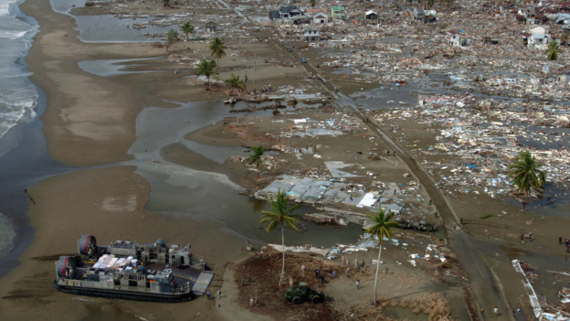
Day_172 : Hollywood Movie “The Beach” and The 2004 Indian Ocean Tsunami in Thailand

Past writings are to be disclosed little by little, with some changes.

>>>>>>>>>>>>>>>>>>>>>>>>>>>>

The Supreme Court of Thailand ordered 20th Century Fox Inc. and its local subsidiaries to restore the ecosystem of Phi Phi Island, acknowledging that the company degraded the environment around Phi Phi Lei Island for the filming of the Hollywood movie “The Beach” in 2000 on December 7, 2006. The film, starring Leonardo DiCaprio, has made great strides in the development of tourism on the island and displaced many tourists, but the island was one of the worst affected areas by the Indian Ocean Tsunami of late 2004, and many tourists lost their lives.

Flyer: The Movie “Tha Beach”

Tourism development for economic development and environmental issues lay largely in the background of why Koh Phi Phi was one of the hardest-hit areas by the tsunami in Thailand.

It all started with the baht crisis that hit the Thai economy in 1997. In the early 1990s, the Thai government established the Ministry of Science, Technology and Environment and the Environmental Fund, enacted a number of environmental laws and enacted a national environmental boom, which began in the early 1990s. A prime example is a controversy over the alteration of the environment for Hollywood movies, known as “the beach controversy,” which began in 1998.

This was sparked by an attempt by a film crew to alter the landscape of Maya Beach on the island of Phi Phi Ley. For the filming of football game scenes, the sandy beach was widened by bulldozers, and non-indigenous coco palm trees were imported and planted on the beach to create an image of a tropical paradise. The Royal Forest Department’s decision to approve the alteration was a measure that went so far as to bend the law in order to attract international investment with the aim of reviving the Thai economy.

This has led to the neglect of nature conservation, and local NGOs and others have begun to investigate and prosecute the environmental degradation around the island.

The tsunami that struck Phi Phi Island on December 26, 2004, occurred in the midst of such tourism development.

Now, two years after the tsunami, the island of Phi Phi Lei and the surrounding areas have regained their natural beauty, having been cleared of the man-made nature created by the tsunami.

Mr. Songboon of TOT Krabi Province, a major telecommunications company in Thailand, said, “I’ve been watching Phi Phi Island for a long time, but the sea was the dirtiest just before the tsunami. He said with great emotion, “The beaches around the area after the tsunami have regained the beauty of 10 years ago. He is currently staying on Phi Phi don Island to set up an internet connection.

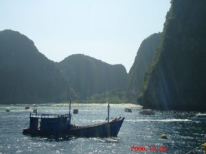
Picture: Maya Beach

Mr. Spar, who runs a dive shop in the hard-hit Thongsai Bay, said, “For a while after the tsunami, we were in a vicious circle, with fewer customers and higher rates for the limited accommodations available to stay, and even fewer customers. However, now the sea itself is getting very clean, the city has recovered a lot, and the customers have returned. Management is getting a little better, too. and a glimpse of hope.

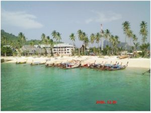
Picture: Thongsai Bay

Supreme Court decision that seems too little, too late. It will be interesting to see how Phi Phi Island rebuilds and learn from the experience of the tsunami and its recovery process.

Reference:
Natural Disasters and Disaster Management in Thailand

Nikkan Berita (edited and rearranged for this post)
Nikkan Berita Writer’s Archive December 30, 2006


Day_171 : Past Interview Records – PTWC (Pacific Tsunami Warning Center) in Hawaii (2)

Interview Records at PTWC No. 2
2008.2.26 (Tue.) at 1000 am

The records from the interview survey are shown below.

■ Science and technology
Many models of the tsunami have been developed. However, it is difficult to adopt because it is crucial whether it is practical or not.

■ Staff training
Only internal training is available.

■ A system where Civil Defense gives warnings to citizens.
There is a hotline to the provincial government and another one to the federal government.

■ Work shift
One person is always at the center for 24 hours.
8hr-4hr-4hr 4hr 16hrs are in shift
When there is a problem, three staff gather at the center.

■ Backup
The center’s backup is at the Alaska center and if Hawaii doesn’t work,. Alaska center can cover.

■ Relationship with media
Concerning the media, media is, in a sense, a partner.
Civil Defense needs 3 hours before the event to evacuate. for that reason, there are too many time constraints. The media is fast. However, there are various restrictions. To decide to proceed with the warning or not, the media has no such authority. Also, in the United States, the media is a business and not state-owned, so it could mislead. You must always pay attention to the points.

■ Resources
Before the tsunami damage of 2004, the conditions were very limited in terms of resources. A lot of money has been invested in this field since the beginning of the year. The function of the center has been improved because of that. The staff has increased. The 2004 event was a severe tsunami disaster, letting the world know the reality.

Related information . and Books
The following tsunami warning center provides the world situations on the map and list
U.S, Tsunami Warning Centers