Day_34 : The meanings of the Typhoon Makurazaki in 1945

Japan was vulnerable after the Second World War, so we had many natural disasters, especially Typhoon disasters, from 1945 to 1959. Some call this 15 years a great flood and storm era. The first hit was Typhoon Makurazaki on September 15, 1945*. The typhoon hit Hiroshima city. There were 1229 casualties in the city. This fact reminds us of what happened in Hiroshima in the same year. The atomic bomb hit Hiroshima city this August. We had no weather forecast system during the war because of military reasons. The people in Hiroshima were living in vulnerable houses because the bomb hardly hit them. They did not have enough information about the typhoon’s coming, either. Therefore, this typhoon disaster is a complex disaster consisting of natural, technological, and human-made disasters.

*Hiroshima Pref. Website:
http://www.bousai.pref.hiroshima.jp.e.bq.hp.transer.com/www/contents/1318849427179/index.html
http://www.pref.hiroshima.lg.jp.e.bq.hp.transer.com/soshiki/100/makurazaki.html

**A Blank in the Weather Map by Kunio Yanagida

https://en.wikipedia.org/wiki/A_Blank_in_the_Weather_Map


Day_129 : Natural Disasters in China (1) – Two Earthquake Disasters

Overviews

The overviews of Natural Disasters in China are the followings:

1) Death numbers
death_china2
Source: EM-DAT

2) Affected numbers
affected_china
Source: EM-DAT

3) Damage costs
damage_china
Source: EM-DAT

Natural disasters in China are very large scales, reflecting country’s population and geographical size. Also, we need to know that China has a rapidly growing economy. We can confirm the normal historical trends of natural disasters, from human sufferings to economic damages, which this note already mentioned (Day 77). For instance, the top 10 deadliest natural disasters in China are all before 1970s. On the contrary, the top 10 costliest natural disasters in China all occurred after 1990s.

Two Earthquakes
Yang Zhang William Drake et al. (2016)* indicate interesting views on two earthquake disaster recoveries: the 1976 Tangshan earthquake and the 2008 Wenchuan earthquake. The point is why the 2008 Wenchuan earthquake recovery was so rapid compared to the 1976 earthquake.
However, the paper could add the total background changes in China, such as the economy and politics. China has changed dramatically since 1976, from historical viewpoints.

A comparison of the two earthquakes will be explained.

Yang Zhang William Drake et al. (2016), Disaster Recovery Planning after Two Catastrophes: The 1976 Tangshan Earthquake and the 2008 Wenchuan Earthquake, International Journal of Mass Emergencies and Disasters, 34(2):174–200.

Day_203 : Distant Tsunamis Triggered by Massive Earthquakes: The 1960 Chilean Earthquake and the 2004 Indian Ocean Tsunami

On the early morning of May 23, 1960, a massive earthquake, the largest ever recorded with a magnitude of 9.5, struck southern Chile. This earthquake unleashed a tsunami that swiftly crossed the Pacific Ocean, reaching the Japanese coast about 22.5 hours later. The tsunami, which surged up to 8 meters high, resulted in 139 deaths and caused the destruction or displacement of 2,830 buildings across Japan. Due to the geographical position of Chile opposite Japan, the tsunami’s impact was more pronounced upon reaching the Japanese shores. These distant tsunamis are particularly challenging to forecast since they occur without the preliminary tremors typically associated with earthquakes. Consequently, regions prone to seismic activity, particularly around the Pacific, including Hawaii, have established early warning systems.

Day_168 : Past Interview Records – PTWC (Pacific Tsunami Warning Center) in Hawaii (1)


In 2004, the Indian Ocean was struck by another significant earthquake, which triggered a devastating tsunami. At that time, the absence of a tsunami warning system in the Indian Ocean contributed to a staggering death toll of 300,000. The effectiveness of tsunami warnings is limited by their ability to reach extensive coastal areas promptly. Therefore, it is crucial for residents to be aware of their local environmental characteristics and rely on personal judgment and preparedness to mitigate the risks posed by tsunamis.

Day_202 : What is Inland Flooding?

When it rains heavily on a flat area, the rainwater does not drain away and accumulates on the ground. Water flows into low areas from surrounding small elevations. Drainage canals and small rivers are the first to overflow as water levels rise. Floods that occur in this way are called internal floods and are distinguished from external floods that occur when the levees of main rivers break or overflow. In general, internal floods include the overflows of relatively large drainage rivers that have their source in the plain and the overflows of small rivers on plateaus and hillsides into lowlands at the bottom of valleys. Floods caused by internal flooding are particularly problematic in cities and surrounding newly developed urbanized areas. What is called “urban flooding” is the flooding of urban areas, which is intensified by the structure of the city and creates new types of damage, such as the inundation of underground malls.

Day_89 : Disaster Recovery Theory (1)

First, the theoretical examination’s concept is explained and two disaster recovery theories are introduced. Second, the first theory is explained and studied. Third, the second theory is explained and examined.

The concept is explained as follows:

The concept

Figure1 1: Disaster Recovery Concept

The following are the two disaster recovery theories used for this study.
Theoretical framework 1
Disasters contribute to change, they do so primarily by accelerating trends that are already underway prior to impact (Bates et al., 1963; Bates, 1982; Bates and Peacock, 1993; Haas et al., 1977).

2) Theoretical framework 2
The disaster Process is influenced by
① Devoted aid volume from outside society
② Disaster scale
Community Strength (Social System Strength) (Hirose, 1982)

The first theory is confirmed by some cases. You can see the following figures: the Kanto earthquake, Fukui earthquake, Typhoon Isewan in Japan, and Hurricane Katrina in US.
mizutanisensei_recovery
Figure 2: Disaster Recoveries in Japan

recovery_katrina
Figure 3: The Disaster Recovery from Hurricane Katrina in US.

To be continued…

This is  the presentation summary. The presentation was made in 2011, after the tsunami in Japan.

Day_200 : High-Speed Tsunamis and Delayed Warnings: The Urgency of Evacuation during the 1896 Meiji Sanriku, 1933 Showa Sanriku, and 2011 Great East Japan Earthquake and Tsunamis

Large tsunamis are caused by significant earthquakes of magnitude eight or greater. In particular, such earthquakes frequently occur along the Pacific coast of Hokkaido and Tohoku in Japan. The Sanriku coast in this region has a unique shape called a “rias coast,” which is prone to tsunamis. In the 1896 Meiji Sanriku tsunami, the tsunami reached a height of 38 meters and killed about 22,000 people. Thirty-seven years later, in 1933, another major tsunami, the Showa Sanriku tsunami, struck the region, killing approximately 3,000 people. 2011’s Great East Japan Earthquake and Tsunami did not fully apply the lessons of the past, leaving approximately 18,000 people dead or missing.

The time between an earthquake and a tsunami reaching the coast is very short, from 5 to 10 minutes. Running to higher ground quickly is almost the only way to protect yourself from a tsunami. The tsunami will reach the coast where it is the highest and also get to the coast the fastest. Therefore, instead of waiting for information from the outside, it is essential to have knowledge about tsunamis, understand your surroundings, and act on your judgment.

Contents (in Japanese)
Source: URL:https://dil.bosai.go.jp/workshop/2006workshop/gakusyukai21.html

Day_199 : Early Signs of Geological Changes Before Landslides

Before significant landslides occur, various clear natural changes are often observed. Notable incidents include the 1963 Vajont Dam landslide in Italy and the 2006 Leyte Island landslide in the Philippines.

On the evening of October 9, 1963, a massive landslide took place near the Vajont Dam in the Alps of northern Italy. The dam, standing at 262 meters, was completed just three years prior. The landslide dislodged approximately 260 million cubic meters of earth, thrusting up the waters of the dam’s lake. The displaced water surged over the dam, rising more than 100 meters before rushing down into the valley below, resulting in approximately 2,000 fatalities. The geological layers in the area were unstable, compounded by the increased water levels from the dam. A minor landslide had previously occurred in 1960, and the landslide’s progress accelerated to several tens of centimeters per day just before the disaster. Despite ongoing monitoring, the catastrophic damage could not be prevented.

Day_140 : Natural Disasters in Europe (2) Vajont Dam Collapse


On February 17, 2006, a mountain 800 meters tall on the Philippine island of Leyte succumbed to a vast landslide, displacing around 20 million cubic meters of soil and claiming 1,144 lives. Before the collapse, cracks had appeared on the mountain’s ridge, and rainfall had begun to seep into the ground.

Identifying these early signs of geological change is crucial. By monitoring their progression and predicting potential danger zones, we can enhance our preparedness and safeguard our lives against such devastating natural disasters.

Contents (in Japanese)
Source: URL:https://dil.bosai.go.jp/workshop/2006workshop/gakusyukai21.html


What causes a landslide?


Day_198 : Characteristics of Earthquake Disasters

In most cases, when a strong earthquake occurs, many people die as buildings collapse. For example, in the Kobe earthquake, more than 90% of the 5,000 people who died lost their lives within 15 minutes immediately after the quake. For this reason, it is essential to build buildings well to reduce the number of people who die in earthquakes. This will prevent fires, make it less likely that people will lose their homes and become permanent refugees, and reduce the problems of relief and rebuilding.

In developing countries, especially in arid and semi-arid regions, earthquakes cause many deaths. In such areas, sun-dried bricks called “adobe” are common building materials, and buildings made of these bricks often collapse easily in earthquakes, burying many people alive. In developing countries, for economic reasons, standards for building earthquake-resistant buildings are usually low, and construction is often inadequate. Therefore, even earthquakes that are not strong can easily cause severe damage. In addition, in regions with many wooden houses, such as Central America and Southeast Asia, buildings can collapse and catch fire.

Day_197 : The Science of Lightning: A Fascinating Force of Nature

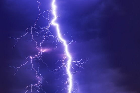
Ever caught yourself staring at the sky, mesmerized by lightning during a storm? This natural marvel is not only captivating but also perilous. Despite centuries of study, the intricacies of lightning strikes continue to be a field of active research. In this exploration, we delve into how lightning forms, its types, associated dangers, and the science of thunder, providing insights for both enthusiasts and the casually curious.

Formation of Lightning

Lightning originates from electric charges accumulating in the atmosphere. This process begins as the sun warms the Earth, causing air to rise, cool, and form clouds. Inside these clouds, the movement of water droplets and ice particles generates an electrical charge. A significant charge difference between parts of the cloud or between the cloud and the ground can ignite a spark—lightning. The intense heat from a lightning strike causes air to expand, creating thunder.

Types of Lightning

Lightning manifests in various forms, including:

Cloud-to-Ground Lightning: The most familiar type, where a bolt strikes from the cloud to the Earth.

Intra-Cloud and Cloud-to-Cloud Lightning: Occurring within or between clouds, respectively.

Ball Lightning: A rare phenomenon of a glowing orb appearing during storms, whose origin remains a mystery.

The Thunder Phenomenon

Thunder is the sound produced by the rapid expansion of air around a lightning bolt. Timing the gap between seeing lightning and hearing thunder can estimate the distance of the strike—every five seconds equals approximately one mile.

Dispelling Lightning Myths

Contrary to popular belief, lightning can strike the same place more than once, especially if it’s a tall structure. Also, while buildings offer better protection than being outdoors, they are not entirely safe from lightning strikes.

Staying Safe During Storms

To minimize risk during thunderstorms:

Stay indoors and unplug electronics.

Seek shelter in a vehicle or sturdy building if outside.

Keep away from tall objects like trees and poles.

Spread out if in a group to reduce the risk of multiple injuries.

Tracking and Protecting Against Lightning

Modern technology, including lightning detectors and mappers, helps track and analyze lightning activity. For protection, lightning rods and surge protectors can safeguard buildings and electronics from strike-induced damages.

Lightning and Climate Change

There’s growing evidence that climate change may increase lightning frequency by creating more thunderstorm conditions. However, further research is needed to understand this relationship fully.

In Conclusion

Lightning, a compelling display of nature’s might, offers much to learn and appreciate. Understanding its science not only enhances our wonder but can also guide us in safeguarding against its dangers. So next time a storm lights up the sky, remember the fascinating science behind each bolt.

Day_138 : Natural Disasters in Europe (1)

Natural disasters in Europe mainly consist of hydrological, meteorological, climatological, earthquake and volcano eruption disasters.

europe-pic
Figure   The Europe

Earthquake disasters mainly occur in the Aegean Sea, the south-western coast of Balkan Peninsula, and the southern part of Italy. Volcanoes are active in the central and southern parts of Italy, the southern Aegean Sea, and Iceland area.

Concerning hydrological, meteorological, and climatological disasters, heavy rain and storm disasters are caused by low  pressure in the Icelandic area developed in the winter season. A cold atmospheric current coming from Arctic gains a warmer vapor stream from the Gulf Stream and develops a strong atmospheric depression in the area. This causes the strong winds and high tidal waves along the coastal areas of the North Sea.

Netherlands and England can be highlighted. The Netherlands had storm surges in 1530 and 1570. The death tolls were approximately 400,000 (1530) and 70,000 (1570) for each. The 1953 depression took an 1800-person death toll. This disaster also reached England. England’s disasters were the 1703 Thames river flood and the 2003 Heatwave. The temperature was 8–10 over the average year in August 2003.

With regard to earthquake disasters, Italy, Greece, and Portugal are the main countries to be affected.

The following past article explains the recent earthquake cases in Italy.

To be continued…