
The following books are very useful to understand disasters.
1. At Risk : Natural Hazards, People’s Vulnerability, and Disasters
2. Measuring Vulnerability
3. Disaster Theory
These will be explained later.
Category Archives: Disaster Risk Reduction
Day_52 : The PDNA (Fiji, cycloone winston ) was issued
The Post Disaster Needs Assessment with regard to cyclone winston disaster in Fiji was issued.
TC Winston’s passage from Fiji, reports emerged of widespread damage and destruction, with the cyclone impacting approximately 540,400 people, equivalent to 62 percent of the country’s total population.
The storm brought down the power and communications systems linking the islands, with approximately 80 percent of the nation’s population, losing power, including the entire island of Vanua Levu, and 44 fatalities were subsequently confir1med. Entire communities were destroyed and approximately 40,000 people required immediate assistance following the cyclone.30,369 houses,495 schools and 88 health clinics and medical facilities were damaged or destroyed. In addition, the cyclone destroyed
crops on a large scale and compromised the livelihoods of almost 60 percent of Fiji’s population.
Other related info.
Relief web
http://reliefweb.int/disaster/tc-2016-000014-fji
The below link, Economic Commission for Latin America and Caribbean (ECLAC) disaster assessment handbook, is really really core of the disaster assessment field.
http://www.cepal.org/en/publications/handbook-disaster-assessment

Day_51 : Matsushiro Earthquake and Underground Imperial Headquarter
The Matsushiro Earthquake Research Center is located in Nagano Prefecture. It was established in 1967 by the Matsushiro Earthquake Observatory, Japan Meteorological Agency. The center’s background was based on the world’s rare earthquake swarm in the area. From 1965 to 1969, 6,780 earthquakes were observed, and they became social issues.
There are two famous stories about the establishment. The first story is that the mayor, Mr. Nakamura, declared, “We want to have science and research rather than equipment and money” after the earthquake swarm. This attracted the center. The second is that the location was the place where the planned underground imperial headquarters was just before the end of the Second World War. This explains the location, which is deep underground and has a strong structure. So this means the best location to place a seismometer.
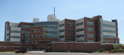
Day_50 : NWC and Univ. of Oklahoma
Do you know the disaster movie, twister*? This is a very nice movie to recognize the tornado disasters and scientific perspectives. The one of the model location is Oklahoma.
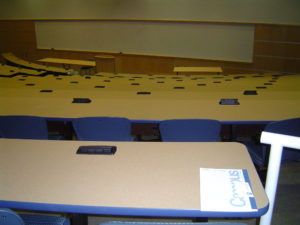
I had an opportunity to visit the National Weather Center (NWC) **and University of Oklahoma to study on disaster information process in 2007, sorry long long time ago. The NWC is located in the University campus. The NWC is the core of not only research activities, but also for contributing to the general public. The University has a lot of shelters inside the buildings***.
The University was active to disseminate the information to the general public. Especially, I learned a lot about the university’s social role for local communities.
There were some shelters in front of the houses in the areas****.
*
https://en.wikipedia.org/wiki/Twister_(1996_film)
**
*** University’s auditorium (Can be transformed to a shelter during the time)
****
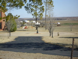
I will write more……
Day_45 : IRDR (Integrated Research on Disaster Risk)
Leave a reply
I was involved to do research on Japanese tsunami in 2011 as a pat of IRDR (Integrated Research on Disaster Risk) project.The IRDR is an international effort. Especially I was really, really impressed by the sentence raised by ICSU (International Council for Science).
Unfortunately, there is a great shortfall in current research on how science is used to shape social and political decision-making in the context of hazards and disasters. Addressing this problem requires an approach that integrates research and policy-making across all hazards, disciplines and geographic regions. The IRDR Programme endeavours to bring together the natural, socio-economic, health and engineering sciences in a coordinated effort to reduce the risks associated with natural hazards.(http://www.icsu.org/what-we-do/interdisciplinary-bodies/irdr/?icsudocid=about-irdr)
Related links
IRDR
http://www.irdrinternational.org/
IRDR-ICSU
http://www.icsu.org/what-we-do/interdisciplinary-bodies/irdr/?icsudocid=about-irdr
[ad#ads1]
Day_38 : Disaster Information 2
Introduce to you how we can collect disaster information again. Disaster researchers should access to disaster data to do research. The following is the available disaster data.
1) General info. 2) Database 3) Update info
Disaster researcher also needs to access to demographic, socioeconomic, and other data from the national level to local one to know the areas and localities.
Disaster Data
1) General info
1. UNISDR
http://www.unisdr.org/we/inform/disaster-statistics
2) Database
1. EM-DAT
http://www.emdat.be/
2. DesInventor
http://www.desinventar.net/index_www.html
3) Update info.
1. ReliefWeb
http://reliefweb.int/disasters
2. ADRC
http://www.adrc.asia/
3. ROSE
http://hisz.rsoe.hu/
4. GDACS
http://www.gdacs.org/
Data on Demographic, socioeconomic, and others
County Level
1. UN data
http://data.un.org/
2. World Bank open data
http://data.worldbank.org/
3. CIA world factbook
https://www.cia.gov/library/publications/the-world-factbook/
Provincial (States) Level
1. Government Office (National Statistics Office,etc.)
Community Level
1. Local Government OfficeThe followings are useful.
The detail will be explained later.
Day_35 : Technological Disasters
Concerning the technological disasters in Japan, we had a lot of pollution issues after the Second World War. We had been seeking economic development first and tended to neglect the side effects. There are four major issues, Minamata disease, Niigata Minamata disease, Yokkaichi asthma, and Itai-itai disease. The issues had been uncovered, especially from the late 1950s to 1960s.
The followings are the youtube videos from TVE we can see the situations.
Day_30: The two main gaps
There are two main gaps among experts, local disaster managers, and local people. The one is a perspective gap, experts usually have a different point of views on the disaster risk reductions based on their specialty. The disaster managers have a management point of views. The local people tend to have the views based on their daily lives.
The other gap is a knowledge gap. Each has a different level of the knowledge. These two gaps keep them from conducting effective disaster risk reduction works in a local community.
Day_28 : サイクルモデル 【1】 [Japanese]
開発・環境・災害のサイクルモデルというのを大分前ですが、提唱させて頂きました。アブストラクトは以下です。
http://ci.nii.ac.jp/naid/110008664615
簡単にいえば、開発が環境を改変し、環境が災害を生み出すということです。開発にも、経済開発、社会開発、人間開発とあり、それぞれ、内からと外からの見方があります。環境には、自然環境と社会環境があります。災害は以前述べたように、自然災害、技術災害、そして人為的災害からなります。このサイクルモデルを今後もっと有効に使おうと考えています。
[ad#ads1]
Day_19:POCT 概略 [Japanese]
2015年の仙台会議で防災対策としてPreparedness(事前準備)とbuilding back better(よりよい復興)の重要性が強調されましたが、POCT(臨床現場即時検査)*はまさに今必要とされている災害対応の具体的かつ実践的な処方箋の一つであることは間違いないと思います。
POCTとはいったい何か、どんなメリットがあるかについて、一例をあげると、災害現場では、まずトリアージによって、患者を選別するかと思いますが、医師も人間ですので、瞬時にすべて上手く選別するにも限界があります。これが深刻な問題となっています。2005年の尼崎の列車脱線事故ではその問題が指摘されました。さらにいえば、緊急治療群として適切に赤タグを付けられた場合でさえも、そのグループに多数がいる場合、その中で誰を優先に搬送すればよいかなどの優先順位の問題が生じます。災害時には、医療は緊急性が優先されるために、瞬時の医師の判断が要求されますが、上手く分類するには、それだけの知識と経験が必要ですし、さらに上手く分類できたとしてもそのなかで優先順位をつけなければなりません。POCTは、この問題を解決に大いに貢献します。つまり、迅速に対応できる簡易臨床検査によって、これまでの経験による判断に数値的な裏づけが加わることを可能にします。そしてその事例も多くあります。**個人的には、将来POCTは、人口知能と結びつき、より効果的な医療が行われるのではないかと考えています。
なお私は災害の研究者であって災害医療については、まだ初心者です。もし間違いなどありましたらご指摘くださいませ。連絡先は、とりえず、リンク先のClass紹介サイトに示しています。
災害医療としてのPOCTに関する本を少しづつ紹介してみたいと思います。日本にはまだ適当な本が見当たらないため、以下の本の内容を中心に紹介していきます。
Source Book:
Kost, G. J. (n.d.). Global point of care: Strategies for disasters, emergencies, and public health resilience.
災害対応におけるPOCTの世界戦略(案)
<全体像>
本書は、災害対応に関わる世界のPOCT(Point of Care Testing : 臨床現場即時検査)に関する108の事例を55章にて紹介しており、将来の災害、疫病、緊急医療、及び公衆衛生に対するしなやかな対応力(レジリエンス)を高めるロードマップを提供している。ロードマップは、専門家に対してだけではなく、コミュニティにおるすべての人への災害、疫病、緊急事態、さらには、公衆衛生の危機的状況に際してのガイドとなる。それだけではなく、個人の健康戦略の構築にも役立つはずである。本書は、主に次の10項目の内容から構成されている。
第一は、POC (Point of Care)の現状及び将来の方向性
第二は、POCの基本的な概念の紹介
第三は、処方箋と処置を促進する工夫
第四は、命に関わる危機的状況にある患者への迅速な処方箋
第五は、POC検査器具の保守管理
第六は、災害準備体制やレジリエンスを高めるためのPOCの活用
第七は、GIS(地理情報システム)との融合による防災計画に対する貢献
第八は、過去の災害経験のPOCへの貢献
第九は、将来のコミュニティにおける災害準備体制やレジリエンスに関する情報
第十は、POCT(臨床現場即時検査)の戦略、公衆衛生政策、及びガイドラインの紹介
*Point of Care Testing
POCTについては、下記の日本臨床検査自動化学会の定義を参考にしました。
http://www.acute-care.jp/learning/course/immunoassay/poct/16041801.html
** Day_9 Day_11